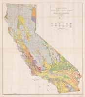
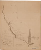
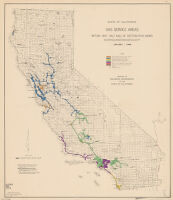
Includes "Map of California showing major rock units and their significance for oil and gas," "Enlarged map of the Los Angeles basin area," index to oil and gas fields, 1 chart and 2 graphs.
Includes text, indexes, inset of "Map of California, showing major rock units and their significance to exploration for tungsten deposits," 2 diagrams, and 5 graphs.
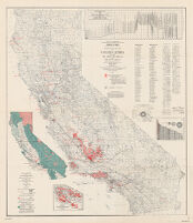
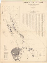
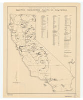
map and statistical data prepared in cooperation with V.C. Heikes, Statistician in Charge, U.S. Bureau of Mines, Department of Commerce, Custom House, San Francisco.
Includes text, indexes, "Map of California, showing major rock units and their significance to exploration for manganese deposits," 2 diagrams and 4 graphs.
Includes "Map of California showing major rock units and their significance for oil and gas," "Enlarged map of the Los Angeles basin area," index to oil and gas fields, 1 chart and 2 graphs.
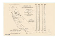
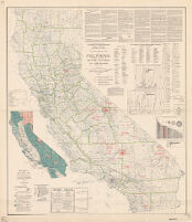
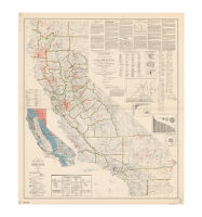
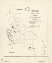
Shows the hydro electric, internal combustion engine and steam electric power plants operated by public utility systems, municipalities, government agencies and others.
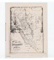
"Base map from U.S. Geological Survey state map. Base revised as to cities and towns on F.A.H.S. [Federal Aid Highway System] and county lines by Bureau of Public Roads, Feb. 1, 1929."
![The unique map of California [electronic resource]](https://iiif.library.ucla.edu/iiif/2/ark%3A%2F21198%2Fzz002b1215/full/!200,200/0/default.jpg)

![[Map of California].](https://iiif.library.ucla.edu/iiif/2/ark%3A%2F21198%2Fzz002b8w70/full/!200,200/0/default.jpg)