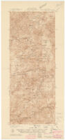
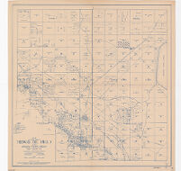
California Tobias Peak quadrangle Description: Includes location map, "Diagram of township," and notes. Date: [1936?] Resource Type: cartographic Collection: Henry J. Bruman Map Collection
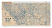
Denny's pocket map of Kern County, California Description: Relief represented by hachures. Date: c1911 Resource Type: cartographic Collection: Henry J. Bruman Map Collection
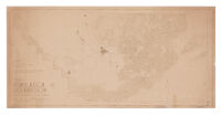
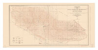
1940 population distribution, Kern County, California Description: Relief represented by hachures. Date: [1940?] Resource Type: cartographic Collection: Henry J. Bruman Map Collection
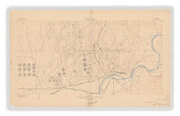
California (Kern County), Oil Center special map. Description: Relief represented by contours. Date: 1906 Resource Type: cartographic Collection: Henry J. Bruman Map Collection
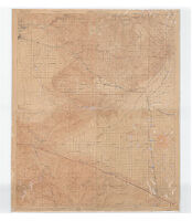
Topographic map, Kern County, California Description: Relief represented by hachures. Date: 1931[1931] Resource Type: cartographic Collection: Henry J. Bruman Map Collection
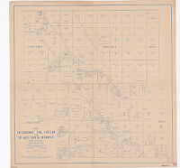
Map of the Belridge Oil Field and McKittrick Front Oil Field, Kern County, Calif. Date: 1920 Resource Type: cartographic Collection: Henry J. Bruman Map Collection
Topographic map of the Naval Petroleum Reserve No. 1 Description: "Control by U.S. Geological Survey, U.S. Coast and Geodetic Survey, and Pan American Petroleum Company. Surveyed in 1927. North American datum." Date: 1930 Resource Type: cartographic Collection: Henry J. Bruman Map Collection
Topography Map of Kern County, California Date: 1923 Resource Type: cartographic Collection: Henry J. Bruman Map Collection
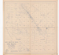
Map of the Lost Hills Oil Field and North Belridge Oil Field Kern County, CA Date: 1920 Resource Type: cartographic Collection: Henry J. Bruman Map Collection
Map of Southern Portion of Midway Oil Field Including Buena Vista Hills Kern County Calif. Date: 1920 Resource Type: cartographic Collection: Henry J. Bruman Map Collection