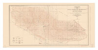
Topographic map of the Naval Petroleum Reserve No. 1
Item Overview
- Title
- Topographic map of the Naval Petroleum Reserve No. 1
- Uniform title
-
Elk Hills Oil Field
Naval Petroleum Reserve no. 1 - Creator
- Geological Survey (U.S.).
- Date Created
- 1930
- Place of Origin
-
[Washington, D.C.]
dcu - Publisher
- Dept. of the Interior, U.S. Geological Survey
- Language
- English
- Collection
- Henry J. Bruman Map Collection
Notes
- Description
-
"Control by U.S. Geological Survey, U.S. Coast and Geodetic Survey, and Pan American Petroleum Company. Surveyed in 1927. North American datum."
Relief represented by contours.
topography by E.P. Davis, C.A. Stonesifer, and R.G. Stevenson. - Caption
- Ed. of 1930.
Physical Description
- Extent
- 1 map : col. ; 43 x 84 cm.
Keywords
- Genre
- map
- Location
-
Kern County (Calif.)
southernmost:N0351300
westernmost:W1193500
northernmost:N0352010
easternmost:W1191800 - Resource type
- cartographic
- Subjects
- Kern County (Calif.)--Maps
Find This Item
- Repository
- University of California, Los Angeles. Library. Henry J. Bruman Map Collection
- ARK
- ark:/21198/zz002b0xq4
- Opac url
- https://search.library.ucla.edu/permalink/01UCS_LAL/17p22dp/alma9915070423606533
- Manifest url
-

Access Condition
- Rights statement
- pd_usfed