Specimen photograph of California poppies. The Tehachapi Mountains is a mountain range in California that extends for approximately 40 miles in southern Kern County and northeastern Los Angeles County. The California poppy (Eschscholzia californica) is a perennial and annual plant native to the United States. The plant is the official state flower of California.
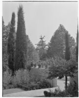
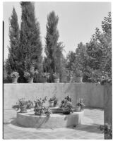
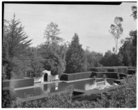
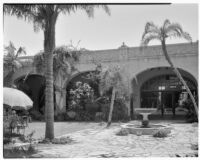
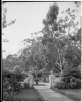
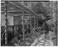
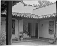
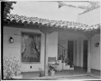
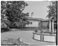
The Ludington estate, also known as Val Verde, Dias Felices, the Henry Dater house, and the Dr. Warren Austin home, was designed by the architect Bertram Grovenor Goodhue, constructed in 1918 and then purchased by Charles H. Ludington in 1924. His son, Wright Saltus Ludington (who inherited the estate in 1927 or 1930), engaged the landscape architect Lockwood de Forest to design the gardens in 1925. Retaining the geometry of Goodhue's design and much of the wilderness, Lockwood transformed the gardens over a period of twenty-three years.
The Ludington estate, also known as Val Verde, Dias Felices, the Henry Dater house, and the Dr. Warren Austin home, was designed by the architect Bertram Grovenor Goodhue, constructed in 1918 and then purchased by Charles H. Ludington in 1924. His son, Wright Saltus Ludington (who inherited the estate in 1927 or 1930), engaged the landscape architect Lockwood de Forest to design the gardens in 1925. Retaining the geometry of Goodhue's design and much of the wilderness, Lockwood transformed the gardens over a period of twenty-three years.
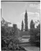
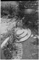
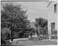
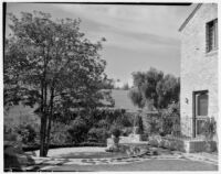
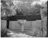
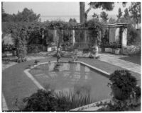
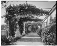
View of a stone basin on a pedestal in a garden area with brick pavement and a low wall incorporating a bench, with a boxwood hedge and trees visible beyond.
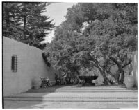
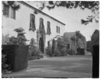
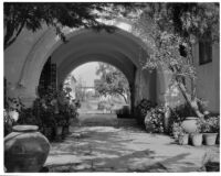
The estate was created in 1929-1930. The architect of the house was Addison C. Mizner and the gardens were designed by Lockwood De Forest. Named Casa Bienvenida by its first owner, Alfred E. Dieterich, the estate is currently known as Park Lane.
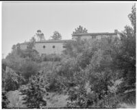
The San Marcos building is located at the corner of State Street and Anapamu Street. The building was partially destroyed in the 1925 Santa Barbara earthquake. After the earthquake, the State street portion was demolished and the third story was removed from the Anapamu section
Specimen photograph of California poppies. The Tehachapi Mountains is a mountain range in California that extends for approximately 40 miles in southern Kern County and northeastern Los Angeles County. The California poppy (Eschscholzia californica) is a perennial and annual plant native to the United States. The plant is the official state flower of California.
Specimen photograph of Washingtonia filifera growing in Palm Canyon, one of the Indian Canyons. Common names for the Washingtonia filifera include California Fan Palm, Desert Fan Palm, Cotton palm, and Arizona Fan Palm.
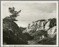
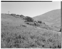
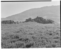
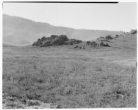
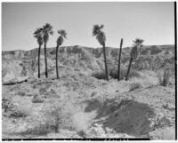
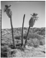
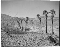
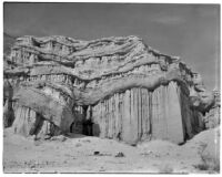
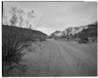
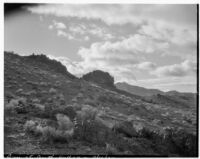
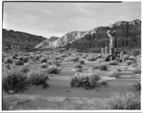
There are several locations called Hell's Acre (Hell's Half Acre more specifically). This is probably Hell's Half Acre between Rock Springs and Casper, Wyoming. It is a desert landscape similar in aesthetics to Badlands National Park. Rocks have been formed into canyons and towering formations by the wind. In this picture there is some low brush and several palm trees.
There are several locations called Hell's Acre (Hell's Half Acre more specifically). This is probably Hell's Half Acre between Rock Springs and Casper, Wyoming. It is a desert landscape similar in aesthetics to Badlands National Park. Rocks have been formed into canyons and towering formations by the wind. In this picture there is some low brush and several palm trees.
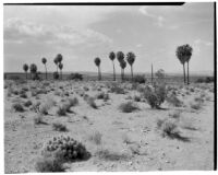
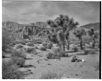
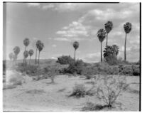
Twentynine Palms is a city in San Bernardino County, California. The city is located in the Mojave Desert. The city was named for the palm trees located in the Oasis of Mara at Joshua Tree National Park.
There are several locations called Hell's Acre (Hell's Half Acre more specifically). This is probably Hell's Half Acre between Rock Springs and Casper, Wyoming. It is a desert landscape similar in aesthetics to Badlands National Park. Rocks have been formed into canyons and towering formations by the wind. In this picture there is some low brush and several palm trees.
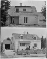
Two views of the Fred G. Young residence under construction and without landscaping. Top photograph captures the back of the residence. The bottom photograph captures the front of the residence. Two unidentified men are standing in the front of the residence.
Red Rock Canyon has been a popular film location for several decades; for this reason, the different rock formations have received popular names. In one postcard, this view is identified as the "Pillars of Hercules"
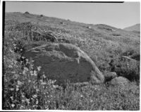
The Tehachapi Mountains is a mountain range in California that extends for approximately 40 miles in southern Kern County and northeastern Los Angeles County.
Twentynine Palms is a city in San Bernardino County, California. The city is located in the Mojave Desert. The city was named for the palm trees located in the Oasis of Mara at Joshua Tree National Park.
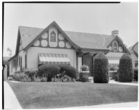
Wikipedia entry for Culver Crest neighborhood, Culver City, Calif.: "Youngworth Road was named for the early developer, whose home is still on the Marycrest Manor property."
Death Valley is a desert valley located in Eastern California. It is located near the border of California and Nevada and is part of Death Valley National Park.
Death Valley is a desert valley located in Eastern California. It is located near the border of California and Nevada and is part of Death Valley National Park.