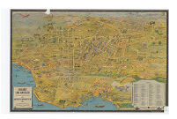
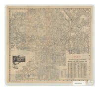
Greater Los Angeles Description: designed by K.M. Leuschner. copyrighted. Published by Metropolitan Surveys. Date: 1932 Resource Type: cartographic Collection: Henry J. Bruman Map Collection
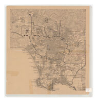
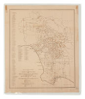
Los Angeles County Administrative Map Date: ND Resource Type: cartographic Collection: Henry J. Bruman Map Collection
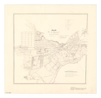
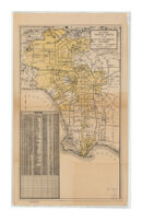
Plan de la ciudad de los Angeles Description: Relief represented by hachures. Resource Type: cartographic Collection: Henry J. Bruman Map Collection
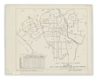
Map of a portion of the City of Los Angeles showing area covered by survey of single family residences vacant and under construction as of the week of November 8, 1937 Description: Includes 3 insets. Date: [1937?]1924c19241937 Resource Type: cartographic Collection: Henry J. Bruman Map Collection
Clason's map of Los Angeles Description: Relief represented by hachures. Date: 1916 Resource Type: cartographic Collection: Henry J. Bruman Map Collection
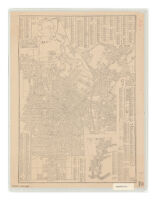
Latest city map of Los Angeles Description: Panel title: Map of Los Angeles. Date: c1925 Resource Type: cartographic Collection: Henry J. Bruman Map Collection
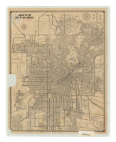
Map of the city of Los Angeles Description: Relief represented by hachures. Date: [1917?] Resource Type: cartographic Collection: Henry J. Bruman Map Collection
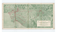
Relief map of territory served by lines of Pacific Electric Railway in southern California, largest electric railway system in the world Description: Relief represented by shading. Date: c19201920 Resource Type: cartographic Collection: Henry J. Bruman Map Collection
Security-First National map of Los Angeles, Hollywood, Pasadena, Glendale, Santa Monica, Alhambra, Huntington Park, Inglewood, Beverly Hills and adjacent cities Description: "Copyrighted by Security-First National Bank of Los Angeles." Date: [1936?] Resource Type: cartographic Collection: Henry J. Bruman Map Collection
City of Los Angeles and the metropolitan district Description: Los Angeles City Health Department, Pest Control Division, Mosquito Control Section. Date: [between 1932 and 1939] Resource Type: cartographic Collection: Henry J. Bruman Map Collection
Map of Los Angeles, California showing Location of Elementary Schools Resource Type: cartographic Collection: Henry J. Bruman Map Collection
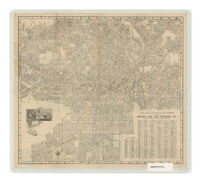
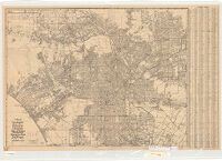
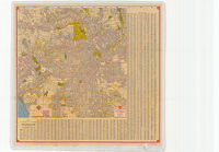
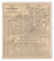
Street map of the city of Los Angeles, California, showing street names together with principal routes in and out of the congested district Description: Panel title: Street map of Los Angeles city and annexations. Date: [193-?] Resource Type: cartographic Collection: Henry J. Bruman Map Collection
Latest city map of Los Angeles Description: Text, ill., and map on verso. Date: c1927 Resource Type: cartographic Collection: Henry J. Bruman Map Collection
Shell map of Los Angeles and vicinity Description: Relief represented by hachures. Date: [1940] Resource Type: cartographic Collection: Henry J. Bruman Map Collection
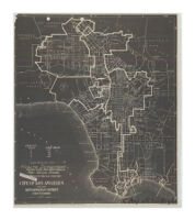
Map Showing Territory Annexed to the City of Los Angeles, California Resource Type: cartographic Collection: Henry J. Bruman Map Collection
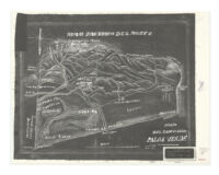
Mar Pacifico Del Norte, "San Pedro" Date: ND Resource Type: cartographic Collection: Henry J. Bruman Map Collection
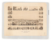
Los Angeles, Los Angeles County, Cal. 1857 Description: "Kuchel & Dresel's California views." Date: [1857]1959 Resource Type: cartographic Collection: Henry J. Bruman Map Collection
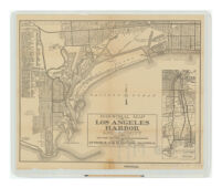
Industrial map of Los Angeles Harbor and vicinity Description: Includes: Index of industrial plants. Date: [ca. 1922?] Resource Type: cartographic Collection: Henry J. Bruman Map Collection
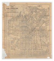
Street map of the city of Los Angeles, California, showing street names together with principal routes in and out of the congested district Description: Relief represented by spot heights. Date: [192-?] Resource Type: cartographic Collection: Henry J. Bruman Map Collection
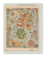
This carefully drawn & precisely executed map and history of El Pueblo de Nuestro Senora de la Riena de Los Angeles Description: At head of title: 1781, 1931. Date: 1931 Resource Type: cartographic Collection: Henry J. Bruman Map Collection