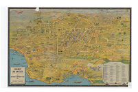
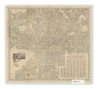
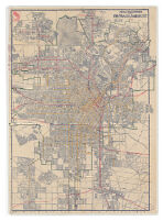
Greater Los Angeles Description: designed by K.M. Leuschner. copyrighted. Published by Metropolitan Surveys. Date: 1932 Resource Type: cartographic Collection: Henry J. Bruman Map Collection
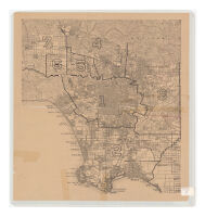
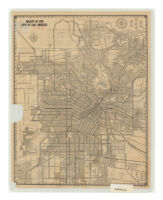
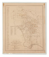
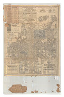
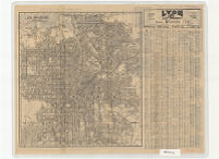
Los Angeles County Administrative Map Date: ND Resource Type: cartographic Collection: Henry J. Bruman Map Collection
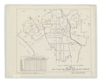
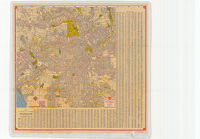
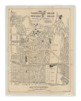
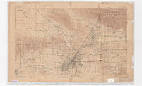
Map of a portion of the City of Los Angeles showing area covered by survey of single family residences vacant and under construction as of the week of November 8, 1937 Description: Includes 3 insets. Date: [1937?]1924c19241937 Resource Type: cartographic Collection: Henry J. Bruman Map Collection
Clason's map of Los Angeles Description: Relief represented by hachures. Date: 1916 Resource Type: cartographic Collection: Henry J. Bruman Map Collection
Latest city map of Los Angeles Description: Panel title: Map of Los Angeles. Date: c1925 Resource Type: cartographic Collection: Henry J. Bruman Map Collection
Map of the city of Los Angeles Description: Relief represented by hachures. Date: [1917?] Resource Type: cartographic Collection: Henry J. Bruman Map Collection
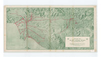
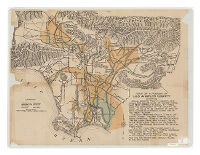
Relief map of territory served by lines of Pacific Electric Railway in southern California, largest electric railway system in the world Description: Relief represented by shading. Date: c19201920 Resource Type: cartographic Collection: Henry J. Bruman Map Collection
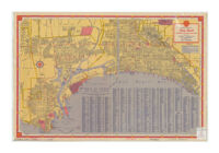
Security-First National map of Los Angeles, Hollywood, Pasadena, Glendale, Santa Monica, Alhambra, Huntington Park, Inglewood, Beverly Hills and adjacent cities Description: "Copyrighted by Security-First National Bank of Los Angeles." Date: [1936?] Resource Type: cartographic Collection: Henry J. Bruman Map Collection
Map of Los Angeles, California showing Location of Elementary Schools Resource Type: cartographic Collection: Henry J. Bruman Map Collection
Latest city map of Los Angeles Description: Text, ill., and map on verso. Date: c1927 Resource Type: cartographic Collection: Henry J. Bruman Map Collection
Shell map of Los Angeles and vicinity Description: Relief represented by hachures. Date: [1940] Resource Type: cartographic Collection: Henry J. Bruman Map Collection
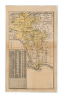
Map Showing Territory Annexed to the City of Los Angeles, California Resource Type: cartographic Collection: Henry J. Bruman Map Collection
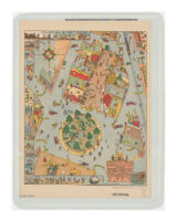
This carefully drawn & precisely executed map and history of El Pueblo de Nuestro Senora de la Riena de Los Angeles Description: At head of title: 1781, 1931. Date: 1931 Resource Type: cartographic Collection: Henry J. Bruman Map Collection
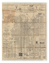
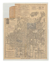
Map of Los Angeles Description: Advertisements, ill., and index on verso. Date: 1904, c1903 Resource Type: cartographic Collection: Henry J. Bruman Map Collection
Map of a Portion of Los Angeles County Date: ND Resource Type: cartographic Collection: Henry J. Bruman Map Collection
Map of Westwood Hills and Holmby Hills Description: "C.E. Chandler 3-10-31." Date: 1927[1931]1944 Resource Type: cartographic Collection: Henry J. Bruman Map Collection
Principal automobile routes in and out of Los Angeles, California Description: Relief represented by hachures. Date: [1919?] Resource Type: cartographic Collection: Henry J. Bruman Map Collection
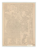
Map of Los Angeles, California Description: Relief represented by hachures. Date: c1934 Resource Type: cartographic Collection: Henry J. Bruman Map Collection
Palisades, Santa Monica by the Sea Resource Type: cartographic Collection: Henry J. Bruman Map Collection
California (Los Angeles Co.) Los Angeles sheet Description: Cartographer: Robert Cormack. Date: 1897 Resource Type: cartographic Collection: Henry J. Bruman Map Collection
Map of Los Angeles Description: Advertisements, ill., and index on verso. Date: 1904, c1903 Resource Type: cartographic Collection: Henry J. Bruman Map Collection
Official sightseeing map, Los Angeles City and County Description: Panel title. Date: c1940 Resource Type: cartographic Collection: Henry J. Bruman Map Collection
Shell street map of Long Beach, Wilmington, San Pedro, Signal Hill Description: Panel title: Shell map of Long Beach, Wilmington, San Pedro, Signal Hill. Date: [1940] Resource Type: cartographic Collection: Henry J. Bruman Map Collection
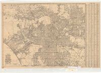
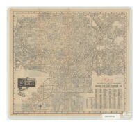
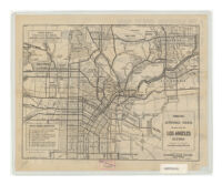
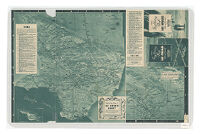
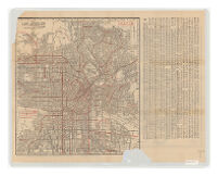
Official transportation and city map of Los Angeles, California, and suburbs Description: Includes 3 insets. Date: 1924c1924 Resource Type: cartographic Collection: Henry J. Bruman Map Collection
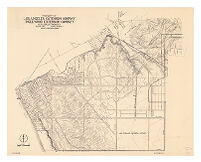
Property of Los Angeles Extension Company, Inglewood Extension Company and adjacent property Description: Relief represented by contours. Date: [1940?]1940 Resource Type: cartographic Collection: Henry J. Bruman Map Collection
Map of Los Angeles, California Description: Relief represented by hachures. Date: c1937 Resource Type: cartographic Collection: Henry J. Bruman Map Collection
Map of Los Angeles, California Description: On verso: Highway map of California, Nevada -- Map of San Fernando Valley addition to the city of Los Angeles. Scales differ. Date: c1938 Resource Type: cartographic Collection: Henry J. Bruman Map Collection
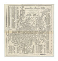
Latest city map of Los Angeles Description: "Wood's revised map of Los Angeles and vicinity" on verso. Date: [1923?] Resource Type: cartographic Collection: Henry J. Bruman Map Collection
Los Angeles in 1881 Description: Includes a bird's-eye view photograph of a scale model of Los Angeles in 1881. Date: 1931 Resource Type: cartographic Collection: Henry J. Bruman Map Collection