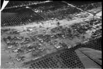
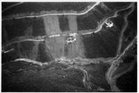
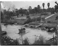
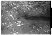
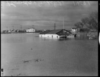
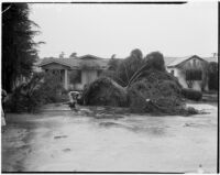
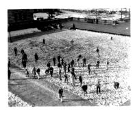
Aerial view of rushing flood waters destroying homes in North Hollywood. The Los Angeles flood of 1938 was a major flooding event that affected much of Los Angeles, Orange County, and Riverside County. The flood was responsible for destroying 5,601 homes, damaging 1,500 homes, and killing approximately 110 people.
The Los Angeles flood of 1938 was a major flooding event that affected much of Los Angeles, Orange County, and Riverside County. The flood was responsible for destroying 5,601 homes, damaging 1,500 homes, and killing approximately 110 people.
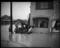
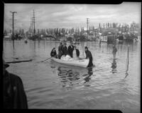
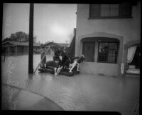
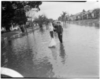
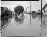
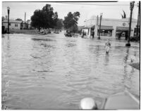
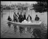
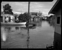
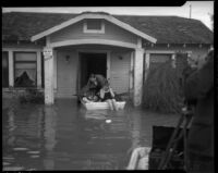
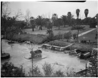
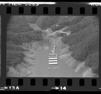
Two boys play with a toy sailboat at 57th and 10th avenue, which was flooded after disastrous storms in January of 1940. The heavy rainstorms halted traffic and caused highway and bridge damage. At least three died and many were treated for injuries
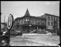
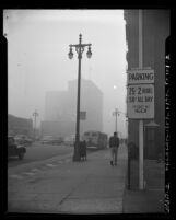
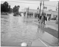
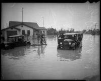
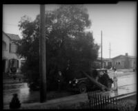
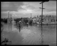
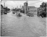
A car attempts to drive through flooding at W. 57th and 11th Avenue after disastrous storms in January of 1940. The heavy rainstorms halted traffic and caused highway and bridge damage. At least three died and many were treated for injuries
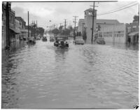
Cars try to navigate flooding at W. 54th and 5th Avenue after disastrous storms in January of 1940. The heavy rainstorms halted traffic and caused highway and bridge damage. At least three died and many were treated for injuries
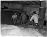
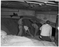
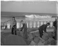
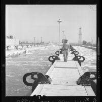
Men use sandbags to protect a waterfront structure from heavy seas at Redondo Beach. In January 1940 the southern stretch of Santa Monica Bay was battered by 25-foot waves, caused by a combination of heavy rain and a mysterious sea disturbance allegedly caused by a submarine. Waves caused damage to shorefront property and at least one person was reported injured.
Men use sandbags to protect a waterfront structure from heavy seas at Redondo Beach. In January 1940 the southern stretch of Santa Monica Bay was battered by 25-foot waves, caused by a combination of heavy rain and a mysterious sea disturbance allegedly caused by a submarine. Waves caused damage to shorefront property and at least one person was reported injured.
A young boy stands in floodwaters at W. 54th and 5th Avenue after disastrous storms in January of 1940. The heavy rainstorms halted traffic and caused highway and bridge damage. At least three died and many were treated for injuries
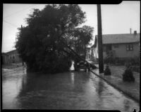
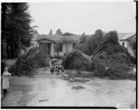
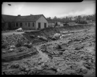
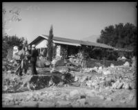
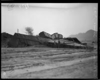
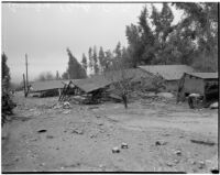
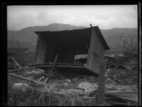
Damage after near-tornado level winds and rain strike Alhambra and neighboring communities of Long Beach and Torrance. Damage in Alhambra extended from City Park to Alhambra Road and Raymond avenue in the northeast, and to Poplar street and Freemont avenue in the southwest. February 13, 1936.
Damage after near-tornado level winds and rain strike Alhambra and neighboring communities of Long Beach and Torrance. Damage in Alhambra extended from City Park to Alhambra Road and Raymond avenue in the northeast, and to Poplar street and Freemont avenue in the southwest. February 13, 1936.
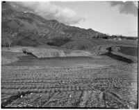
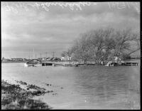
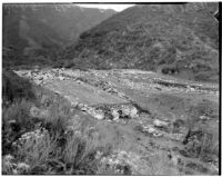
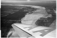
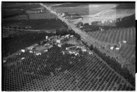
Aerial view of flooded neighborhoods and crops in North Hollywood. The Los Angeles flood of 1938 was a major flooding event that affected much of Los Angeles, Orange County, and Riverside County. The flood was responsible for destroying 5,601 homes, damaging 1,500 homes, and killing approximately 110 people.
The Los Angeles flood of 1938 was a major flooding event that affected much of Los Angeles, Orange County, and Riverside County. The flood was responsible for destroying 5,601 homes, damaging 1,500 homes, and killing approximately 110 people.
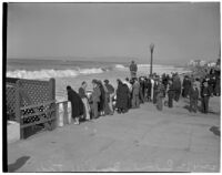
A crowd gathered to see heavy seas at Redondo Beach. In January 1940 the southern stretch of Santa Monica Bay was battered by 25-foot waves, caused by a combination of heavy rain and a mysterious sea disturbance allegedly caused by a submarine. Waves caused damage to shorefront property and at least one person was reported injured.
Men fill sandbags at Redondo Beach to use against heavy seas. In January 1940 the southern stretch of Santa Monica Bay was battered by 25-foot waves, caused by a combination of heavy rain and a mysterious sea disturbance allegedly caused by a submarine. Waves caused damage to shorefront property and at least one person was reported injured.
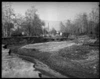
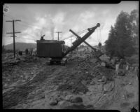
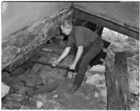
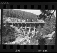
Men work to repair a bridge taken out in the record-breaking rainfall of December 31, 1933. Bridge possibly located near or on Lemoyne street, based on partially-obscured sign present in picture.
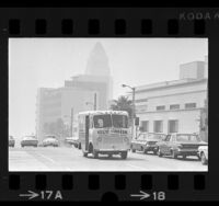
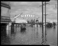
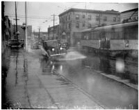
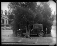
Automobile drives through flooding on Hill St. in Los Angeles. Heavy rains plagued California throughout December 1937. Also in the photo is a Los Angeles Railway car and Hotel Latour
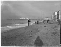
Beachgoers examine high tides at a Los Angeles beach. Throughout the month of December in 1937 frequent swells caused damage all along the Southern California coast. Waves ripped out piers and waterfront buildings and flooded homes. The Hermosa beach municpal pier suffered severe damage to its middle section
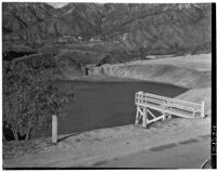
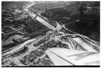
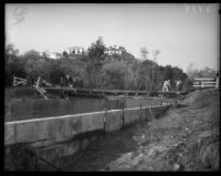
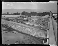
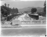
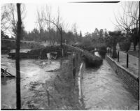
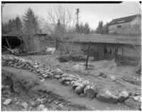
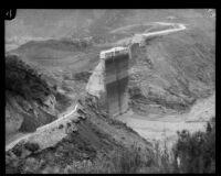
View from the Los Feliz bridge of flood-control construction in the Los Angeles River valley. Construction included building rock-lined levees along the river's curves to deepen and widen the channel and new concrete channels which would confine winter run-off water
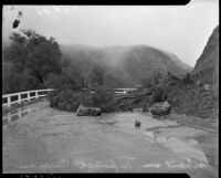
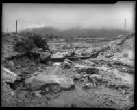
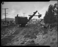
Men at work repairing a swath of damage done to the La Crescenta Highway after torrential rains in that area. Further rains would bring flooding, resulting in more damage and loss of life, in the coming days. December 31, 1933.
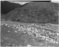
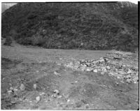
Verdugo Wash, site of one of three major flood control projects begun by the United States Army. Other projects are Compton and Ballona creeks. Project supervisors planned to give an official presentation of the plans to President Roosevelt in hopes of securing the $7,000,000-$8,000,000 needed for all three projects.
Heavy seas on the waterfront at Redondo Beach. In January 1940 the southern stretch of Santa Monica Bay was battered by 25-foot waves, caused by a combination of heavy rain and a mysterious sea disturbance allegedly caused by a submarine. Waves caused damage to shorefront property and at least one person was reported injured.
A group gathered at the corner of W. 54th and 5th Avenue looking at flooding caused by disastrous storms in January of 1940. The heavy rainstorms halted traffic and caused highway and bridge damage. At least three died and many were treated for injuries
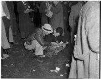
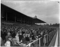
Two men crouched on the ground reading the race listings on a rainy Derby Day at Santa Anita Park. 33,000 spectators came out to watch California-bred Sweepida win the $50,000 Derby.
Man protects a waterfront structure from heavy seas at Redondo Beach. In January 1940 the southern stretch of Santa Monica Bay was battered by 25-foot waves, caused by a combination of heavy rain and a mysterious sea disturbance allegedly caused by a submarine. Waves caused damage to shorefront property and at least one person was reported injured.
Damage after near-tornado level winds and rain strike Alhambra and neighboring communities of Long Beach and Torrance. Damage in Alhambra extended from City Park to Alhambra Road and Raymond avenue in the northeast, and to Poplar street and Freemont avenue in the southwest. February 13, 1936.
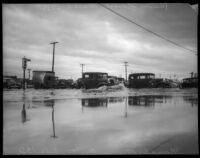
Two men observe the damage left by storms that brought record-breaking rainfall to the Southland. Southern Pacific box cars lie in ruin. December 31, 1933.
The Los Angeles flood of 1938 was a major flooding event that affected much of Los Angeles, Orange County, and Riverside County. The flood was responsible for destroying 5,601 homes, damaging 1,500 homes, and killing approximately 110 people.
Aerial view of flooded crops in North Hollywood. The Los Angeles flood of 1938 was a major flooding event that affected much of Los Angeles, Orange County, and Riverside County. The flood was responsible for destroying 5,601 homes, damaging 1,500 homes, and killing approximately 110 people.
Cars attempt to navigate flooding at W. 54th and 5th Avenue after disastrous storms in January of 1940. The heavy rainstorms halted traffic and caused highway and bridge damage. At least three died and many were treated for injuries
Damage after near-tornado level winds and rain strike Alhambra and neighboring communities of Long Beach and Torrance. Damage in Alhambra extended from City Park to Alhambra Road and Raymond avenue in the northeast, and to Poplar street and Freemont avenue in the southwest. February 13, 1936.
Damage after near-tornado level winds and rain strike Alhambra and neighboring communities of Long Beach and Torrance. Damage in Alhambra extended from City Park to Alhambra Road and Raymond avenue in the northeast, and to Poplar street and Freemont avenue in the southwest. February 13, 1936.
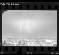
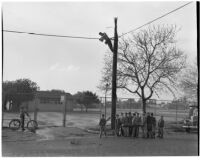
Young boys hold a piece of a telephone pole that broke off when the pole was struck by lightning. The chunk of wood almost hit Philadelphia Athletics manager/director Connie Mack's car when it fell. A repair man is working on the damage.
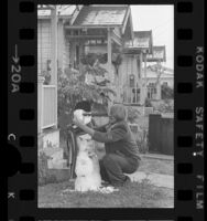
Left to Right: Rodolfo Huerta (father), Robert Huerta (son), and Rosalinda Huerta (mother). This photograph was taken by their neighbor Toni Sfalos outside of their family home in San Antonio, TX. It was taken after a rare snowstorm in South Texas.
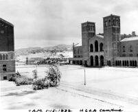
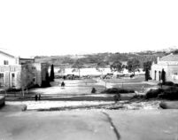
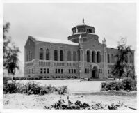
A rare snowfall covers the Esplanade and Royce Hall, viewed here from the foot of the Physics Biology Building (Humanities Building). The Esplanade is more generally called Royce quadrangle and is known today as Dickson Plaza. The edge of the Library (Powell Library) is visible on the left. Hoover took this photograph in the early morning before the pristine snowfall was disturbed by excited students.
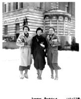
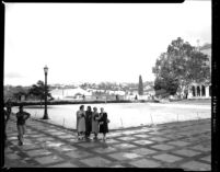
In this photograph titled "Snow Queens" by Hoover, three female students stand in the snow before the south wing of the Education Building (Moore Hall). Many students skipped class to enjoy the rare snowfall on campus.
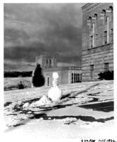
A snowman stands in front of the Education Building (Moore Hall) as a testament to a rare snowfall on campus. Many students skipped class to enjoy the activities, including snowball fights that left fourteen broken windows around campus. Kerckhoff Hall is visible in the background.
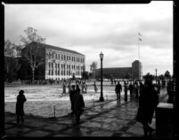
Photographed from Royce Hall, students are seen enjoying a rare snowfall on campus. Many students skipped class to enjoy the activities, including snowball fights that left fourteen broken windows around campus. The Esplanade is more generally called Royce quadrangle and is known today as Dickson Plaza.
Photographed looking west, the Men's Gymnasium (Student Activities Center)--on the left--and the Women's Gymnasium (Kaufman Hall)--on the right--stand amid the melting snow following a rare snowfall on campus.
Between classes, students enjoy a rare snowfall on campus. The Esplanade is more generally called Royce quadrangle and is known today as Dickson Plaza.
Between classes, students enjoy a rare snowfall on campus. Photographed from the entrance to the Library (Powell Library) looking east, the Chemistry Building (Haines Hall)--on the left--and the Business Administration and Economics Building (Dodd Hall)--on the right--appear in the background. The Esplanade is more generally called Royce quadrangle and is known today as Dickson Plaza.
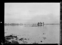
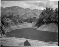
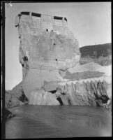
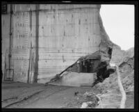
The St. Francis Dam was a 200-foot high concrete gravity-arch dam built between 1924 and 1926 in St. Francisquito Canyon (near present-day Castaic and Santa Clarita). The dam collapsed on March 12, 1928 at two and a half minutes before midnight. The resulting flood killed more than 600 residents plus an unknown number of itinerant farm workers camped in San Francisquito Canyon, making it the 2nd greatest loss of life in California after the 1906 San Francisco earthquake. It is considered the worst American civil engineering failure in the 20th century.
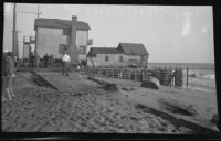
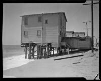
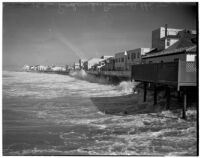
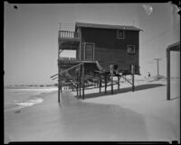
Two-story wooden house with decks on stilts at ocean's edge, with other houses and about 5 people in background, another house partially visible in right foreground
The St. Francis Dam was a 200-foot high concrete gravity-arch dam built between 1924 and 1926 in St. Francisquito Canyon (near present-day Castaic and Santa Clarita). The dam collapsed on March 12, 1928 at two and a half minutes before midnight. The resulting flood killed more than 600 residents plus an unknown number of itinerant farm workers camped in San Francisquito Canyon, making it the 2nd greatest loss of life in California after the 1906 San Francisco earthquake. It is considered the worst American civil engineering failure in the 20th century.
The St. Francis Dam was a 200-foot high concrete gravity-arch dam built between 1924 and 1926 in St. Francisquito Canyon (near present-day Castaic and Santa Clarita). The dam collapsed on March 12, 1928 at two and a half minutes before midnight. The resulting flood killed more than 600 residents plus an unknown number of itinerant farm workers camped in San Francisquito Canyon, making it the 2nd greatest loss of life in California after the 1906 San Francisco earthquake. It is considered the worst American civil engineering failure in the 20th century.
The St. Francis Dam was a 200-foot high concrete gravity-arch dam built between 1924 and 1926 in St. Francisquito Canyon (near present-day Castaic and Santa Clarita). The dam collapsed on March 12, 1928 at two and a half minutes before midnight. The resulting flood killed more than 600 residents plus an unknown number of itinerant farm workers camped in San Francisquito Canyon, making it the 2nd greatest loss of life in California after the 1906 San Francisco earthquake. It is considered the worst American civil engineering failure in the 20th century.
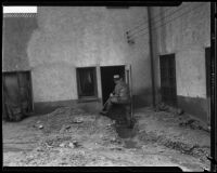
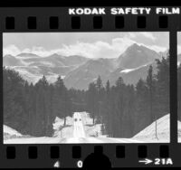
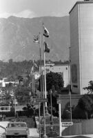
The Los Angeles aqueduct was bombed or otherwise vandalized in at least 10 incidents from 1924 to 1931. Cf. (1) Los Angeles Times article, 20 June 1927, “City Aqueduct Again Blasted, Dynamite Tears Out Sixteen-Foot Section, Fourth Recent Outrage Done During Night Hours, Explosion Occurs Two Miles South of Lone Pine.” The article states: “A heavy charge of dynamite exploded in the fourth attempt within the past month … shattered a sixteen-foot panel of waterway at the Puddle Creek Delta, two miles southwest of Lone Pine … Other outrages. Previous acts of violence against the Aqueduct are as follows: On the 5th inst., the side walls of a large open concrete conduit at the mouth of Cottonwood Canyon were wrecked by a charge of dynamite … May 28, 1927: Approximately 300 feet of the Aqueduct system was blown out at Big Pine … May 27, 1927: … a charge of explosive in No Name Canyon destroying about 450 feet of iron pipe … May 14, 1926: A ten-foot hole was torn out of the concrete Aqueduct by dynamite … about one mile south of the spillway in the Alabama Hills. November 24, 1924: A mob of men … opened the Alabama control gates … between Independence and Lone Pine … May 21, 1924: A heavy charge of dynamite was set off against an open portion of the Aqueduct at a point two miles north of Lone Pine. … No actual damage …” Cf. (2) Los Angeles Times article, 17 July 1927, “Blasts Peril Owens Mills, New Aqueduct Dynamitings Bring Contingency, Lake Level May Tie Up Chemical Plants, Large Repair Crews Rush Reconstruction Work.” The article states: “… two dynamite blasts … early yesterday wrecked the Aqueduct … The latest explosions occurred at Thebaut gate, eight miles north of Independence, and at Tuttle Creek south of Lone Pine. …” Cf. (3) Los Angeles Times article, 3 Nov. 1931, “Officers Trail Aqueduct Dynamiting Suspects, One of Pair Sought Here as Blast Rips Grapevine Siphon; No Water Shortage.” The article states: “Two men were being sought last night for complicity in the explosion of a terrific charge of dynamite which … tore out a section of the grapevine siphon on the Los Angeles Aqueduct, about fifty miles north of Mojave. …”
Related to the article “Tides Bring New Peril, Pilings Smashed From Pier, Property Damage Increases as Oceanic Disturbance Pounds Beach Front, Film People Aid Residents in Erecting Barricades Against Rising Seas.” Los Angeles Times, 7 Sept. 1934.
A photograph of a similar beach house appears with the article “Sea Sneaks Up on Beach Homes, Heavy Tides Peril Newport Houses Built on Stilts,” Los Angeles Times, 25 Oct. 1933.
The St. Francis Dam was a 200-foot high concrete gravity-arch dam built between 1924 and 1926 in St. Francisquito Canyon (near present-day Castaic and Santa Clarita). The dam collapsed on March 12, 1928 at two and a half minutes before midnight. The resulting flood killed more than 600 residents plus an unknown number of itinerant farm workers camped in San Francisquito Canyon, making it the 2nd greatest loss of life in California after the 1906 San Francisco earthquake. It is considered the worst American civil engineering failure in the 20th century.


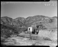


![Flooded area near Los Angeles aqueduct, [1924-1931?]](https://iiif.library.ucla.edu/iiif/2/ark%3A%2F21198%2Fzz002d9ch5/full/!200,200/0/default.jpg)