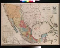
Mapa de los Estados Unidos de Mejico, segun lo organizado y definido por las varias actas del Congreso de dicha republica : y construido por las mejores autoridades Description: Digitization took place as part of the California Cultures Project. Date: 1949 Resource Type: still image Collection: Maps of Los Angeles, California, the United States and the World, circa 1516-1970
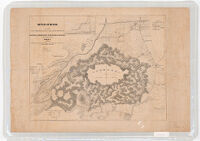
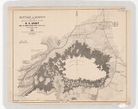
Battles of Mexico: Survey of the Line of Operations of the U.S. Army, Under the Command of Major General Winfield Scott. On the 19th and 20th of August 1847 Date: 1847 Resource Type: cartographic Collection: Henry J. Bruman Map Collection
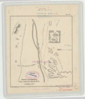
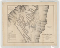
Sketch Accompanying Col. Price's Despatch of 18 April 1847 Date: 1847 Resource Type: cartographic Collection: Henry J. Bruman Map Collection
Sketch Accompanying Col. Price Despatch Date: 1847 Resource Type: cartographic Collection: Henry J. Bruman Map Collection
Battles of Mexico: Line of Operations of the U.S. Army Under the Command of Major Gentral Winfield Scott Date: 1847 Resource Type: cartographic Collection: Henry J. Bruman Map Collection
Plan of the Battle of Buena-Vista Date: 1847 Resource Type: cartographic Collection: Henry J. Bruman Map Collection
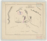
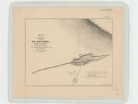
Sketch of the Passage of the Rio San Gabriel, Upper California, by the Americans Date: 1847 Resource Type: cartographic Collection: Henry J. Bruman Map Collection
Battles of Mexico. Survey of the Line of Operations of the U.S. Army Under Command of Major General Winfield Scott Date: 1847 Resource Type: cartographic Collection: Henry J. Bruman Map Collection
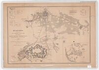
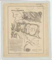
Sketch of the Battle of Sacramento. Feb 28th 1847 Date: 1847 Resource Type: cartographic Collection: Henry J. Bruman Map Collection
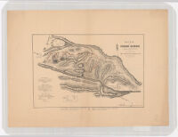
Battle of Cerro Gordo, April 17th and 18th 1847 Date: 1847 Resource Type: cartographic Collection: Henry J. Bruman Map Collection