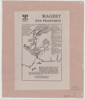
Magert San Francisco Date: 1781 Resource Type: cartographic Collection: Henry J. Bruman Map Collection
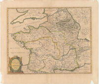
Typvs Galliae Veteris, Ex conatib Geograph. Abrah. Ortelii. Resource Type: cartographic Collection: Henry J. Bruman Map Collection
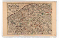
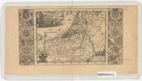
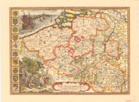
Le Comté de Flandre Date: 1690 Resource Type: cartographic Collection: Henry J. Bruman Map Collection
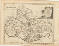
Kirkudbrightshire Date: [1700?] Resource Type: cartographic Collection: Henry J. Bruman Map Collection
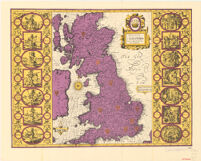
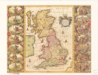
Britian as it was Devided in the tyme of Enghfhe: Saxons eipecially during their Heptarchy Date: 1627 Resource Type: cartographic Collection: Henry J. Bruman Map Collection
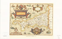
S.R.I Principatvs et. Archiepiscopatus Salisburgensis Date: 1712 Resource Type: cartographic Collection: Henry J. Bruman Map Collection
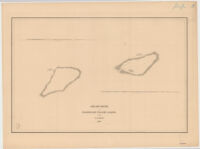
Ahii and Manhii or Peacock and Wilson's Islands by the U.S. Ex. Ex. 1839 Date: 1839 Resource Type: cartographic Collection: Henry J. Bruman Map Collection
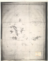
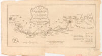
Chart of the Galapagos Surveyed in the Merchant-Ship Rattler, and Drawn by Capt: James Colnett of the Royal Navy in 1793 1794. Date: 1793-1794 Resource Type: cartographic Collection: Henry J. Bruman Map Collection
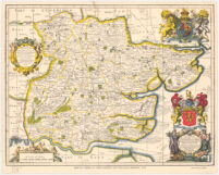
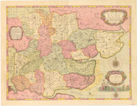
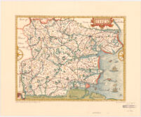
Map of Essex, by John Ogilby and William Morgan, 1678 Date: 1678 Resource Type: cartographic Collection: Henry J. Bruman Map Collection
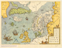
Map of Northern Europe and the Arctic Sea. From the Theatrum Orbis Terrarum by Abraham Ortelius. Date: 1570 Resource Type: cartographic Collection: Henry J. Bruman Map Collection
Map of the County of Essex: By a New Survey. Date: 1696 Resource Type: cartographic Collection: Henry J. Bruman Map Collection
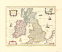
Magne Britanniae et Hiberniae Tabvla Date: 1635 Resource Type: cartographic Collection: Henry J. Bruman Map Collection
Carta Plana de la Provincia de Caracas Date: 1787 Resource Type: cartographic Collection: Henry J. Bruman Map Collection
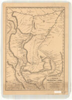
Plan del Curso de los Rios Huallaga y Ucayali y de la Pampa del Sacramento. Date: 1830 Resource Type: cartographic Collection: Henry J. Bruman Map Collection
Saxton's map of Cornwall, 1576 Date: 1960 Resource Type: cartographic Collection: Henry J. Bruman Map Collection
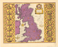
[Ancient Map of British Isles] Date: 1590 Resource Type: cartographic Collection: Henry J. Bruman Map Collection
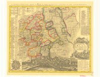
Le XVII Provinces Des Pays Bas Date: [1700?] Resource Type: cartographic Collection: Henry J. Bruman Map Collection
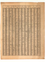
Table Alphabetique des Villes Bourgs & c: qui Sont Sur la du Comte de Flandre par le S'Sanson Date: 1690 Resource Type: cartographic Collection: Henry J. Bruman Map Collection
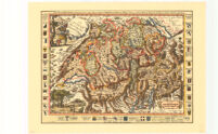
La Svisse Par P. Du Val Geographe du Roy Date: 1677 Resource Type: cartographic Collection: Henry J. Bruman Map Collection
Britannia prout disnifa fuit temporibus Anglo-Saxonvm, prefertim durante illorum Heptarchia. Date: 1646 Resource Type: cartographic Collection: Henry J. Bruman Map Collection
A Plan of the Navigable Canal now making from the City of Coventry, to Communicate with the Grand Canal upon Fradley Heath, in the County of Stafford. Date: 1767 Resource Type: cartographic Collection: Henry J. Bruman Map Collection
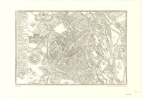
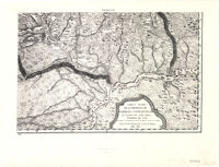
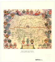
Map of Frankfurt and Its Environs Date: 1638 Resource Type: cartographic Collection: Henry J. Bruman Map Collection
Carta de la Privincia de Quito y de sus Adjacentes Date: 1750 Resource Type: cartographic Collection: Henry J. Bruman Map Collection
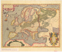
Historical Map of Europe. From the Theatrum Orbis Terrarum by Abraham Ortelius Date: 1595 Resource Type: cartographic Collection: Henry J. Bruman Map Collection
Tractus Nord - Lingensis Germ. Ries. Date: 1738 Resource Type: cartographic Collection: Henry J. Bruman Map Collection
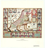
Leo Belgicus - Jan Van Doetecum Date: 1598 Resource Type: cartographic Collection: Henry J. Bruman Map Collection
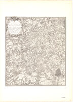
Ferratis Carte Topographique Date: 1769 Resource Type: cartographic Collection: Henry J. Bruman Map Collection
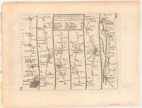
The Road from london to Harwich in Essex Actually Surveyed. Date: [1700?] Resource Type: cartographic Collection: Henry J. Bruman Map Collection
John Norden's Map of Essex, 1594 Date: 1594 Resource Type: cartographic Collection: Henry J. Bruman Map Collection
Facsimile of the Ancient Map of Great Britain in the Bodleian Library, Oxford. Date: 1959 Resource Type: cartographic Collection: Henry J. Bruman Map Collection
Venezvela, cum parte Auftrali Novæ Andalvsiæ. Date: [1629-62] Resource Type: cartographic Collection: Henry J. Bruman Map Collection
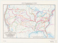
Map of the conterminous United States showing routes of the principal explorers from 1501 to 1844, whose work had an important bearing on the settlement of the country and the fixing of its successive boundaries Description: Original title: United States map showing routes of principal explorers and early roads and highways. Date: 18561983[1956] Resource Type: cartographic Collection: Henry J. Bruman Map Collection
Een gemeene Duytfche Mijle Vne Lieu Commune Date: 1640 Resource Type: cartographic Collection: Henry J. Bruman Map Collection
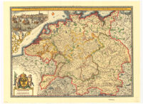
S. Imperium Romano-Germanicum oder Teutschland Mit Seinen Angrantzenden Konigreichen Und Provincien. Date: 1690 Resource Type: cartographic Collection: Henry J. Bruman Map Collection
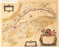
Lacvs Lemanni Locorvmqve Circvm Lacentivm Accvratin Sima Descriptio Date: 1600 Resource Type: cartographic Collection: Henry J. Bruman Map Collection
S.R.I Principatvs et. Archiepiscopatus Salisburgensis Date: 1712 Resource Type: cartographic Collection: Henry J. Bruman Map Collection
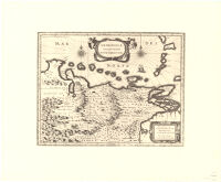
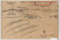
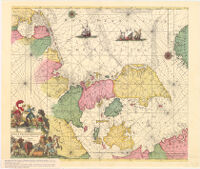
Sea-map with the coasts of Denmark and the Adjoining Regions Date: [1600s] Resource Type: cartographic Collection: Henry J. Bruman Map Collection
Britain as it was devided in the tyme of the Enghfhe: Saxons eipecially during their Heptarchy Date: 1611 Resource Type: cartographic Collection: Henry J. Bruman Map Collection
Pay Bas Catholiqves. Sanson Date: 1667 Resource Type: cartographic Collection: Henry J. Bruman Map Collection
Liverpool and its Environs. [1824] Date: 1973 Resource Type: cartographic Collection: Henry J. Bruman Map Collection

![[Ancient Map of British Isles]](https://iiif.library.ucla.edu/iiif/2/ark%3A%2F21198%2Fzz002cf5t9/full/!200,200/0/default.jpg)
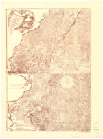
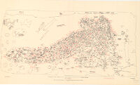

![Liverpool and its Environs. [1824]](https://iiif.library.ucla.edu/iiif/2/ark%3A%2F21198%2Fzz002cf81v/full/!200,200/0/default.jpg)