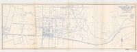
Map of Richfield Oil Field, Orange County, Cal. / Department of Natural Resources, Division of Oil & Gas Date: 1944 Resource Type: cartographic Collection: Henry J. Bruman Map Collection
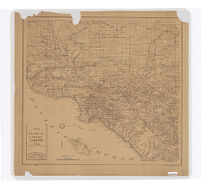
Map of Los Angeles & Orange Counties, Cal Description: Copyright 1914 by Punnett Brothers. Date: c19141914 Resource Type: cartographic Collection: Henry J. Bruman Map Collection
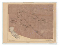
Map of a portion of Los Angeles and Orange Counties, California, showing location of producing oil fields in the Los Angeles Basin as of October 20, 1937 Description: Includes location map. Date: [1937] Resource Type: cartographic Collection: Henry J. Bruman Map Collection
Map of Los Angeles County (southern portion) and western portion of Orange County Description: compiled from official records. Date: 1913 Resource Type: cartographic Collection: Henry J. Bruman Map Collection
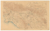
Southern California Sheet No. 1 1921 Date: 1921 Resource Type: cartographic Collection: Henry J. Bruman Map Collection
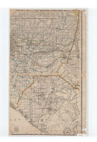
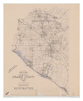
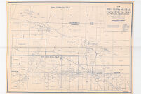
Administration Map Orange County West Half 1943 Date: 1943 Resource Type: cartographic Collection: Henry J. Bruman Map Collection
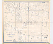
Map of West Coyote Oil Field Date: 1944 Resource Type: cartographic Collection: Henry J. Bruman Map Collection
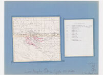
Los Angeles Orange County Oil Fields Resource Type: cartographic Collection: Henry J. Bruman Map Collection
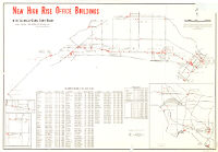
New high rise office buildings in the Los Angeles- Orange County region : includes structures 8 floors and over built since World War II, includes those under construction through 1970. Date: 1971 Collection: Henry J. Bruman Map Collection
Map of Brea Olinda Oil Field and East Coyote Oil Field Los Angeles and Orange Counties Oil Field Date: 1944 Resource Type: cartographic Collection: Henry J. Bruman Map Collection