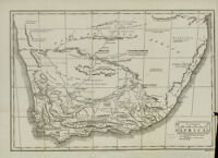
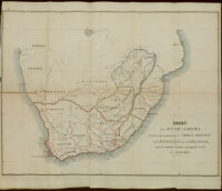
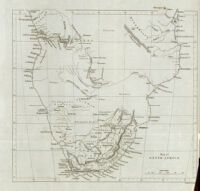
A chart of the southern extremity of Africa Date: 1806 Resource Type: cartographic Collection: Southern African Maps in Books
Africa according to Pigafetta, 1591 Description: Relief shown pictorially. Date: 1893? Resource Type: cartographic Collection: Southern African Maps in Books
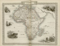
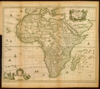
Africa : accurata tabula Description: Relief shown pictorially Date: 1893? Resource Type: cartographic Collection: Southern African Maps in Books
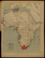
Africa. European possessions in 1884, before the Berlin Conference Date: 1893? Resource Type: cartographic Collection: Southern African Maps in Books
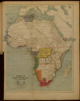
Africa. European possessions in 1885, after the Berlin Conference Date: 1893? Resource Type: cartographic Collection: Southern African Maps in Books
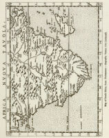
Africa nuova tavola Date: 1561 Resource Type: cartographic Collection: Southern African Maps in Books
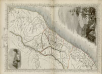
A general map of India Intra Ganges Date: [1930] Resource Type: cartographic Collection: Southern African Maps in Books
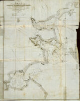
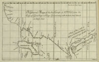
A general mapp of the sea coasts of Africa from the Cape of Good Hope to Cape Guardafoy with the inhabited islands in those seas Date: [1930] Resource Type: cartographic Collection: Southern African Maps in Books
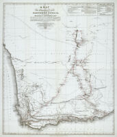
A map of the extratropical part of Southern Africa, constructed by William J. Burchell, Esqr. Date: [1967] Resource Type: cartographic Collection: Southern African Maps in Books
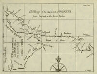
A mapp of the sea coast of Persia from Boserah to the River Indus Date: [1930] Resource Type: cartographic Collection: Southern African Maps in Books
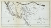
A sketch of the interior of Mozambiue and Benguela Date: 1822 Resource Type: cartographic Collection: Southern African Maps in Books
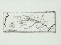
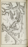
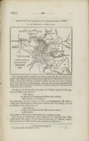
[Autograph letter from R. B. Fisher] Date: 1816 Resource Type: cartographic Collection: Southern African Maps in Books
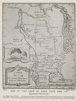
Carte du Cap de Bonne Esperance et de ses environs Date: [1919] Resource Type: cartographic Collection: Southern African Maps in Books
Charte von dem Vorgebürge der Guten Hofnung und den anhegenden Gegenden Date: 1778 Resource Type: cartographic Collection: Southern African Maps in Books
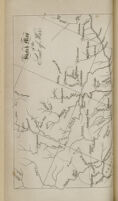
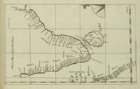
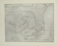
Chart of Port Natal Date: [1936-37] Resource Type: cartographic Collection: Southern African Maps in Books
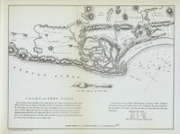
Chart of Port Natal Date: [1970] Resource Type: cartographic Collection: Southern African Maps in Books
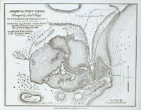
Chart of Port Natal Date: [1963] Resource Type: cartographic Collection: Southern African Maps in Books
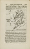
Colburn's united Service magazine and navel and military journal: part 1 page 289 Collection: Southern African Maps in Books
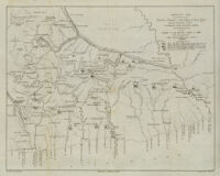
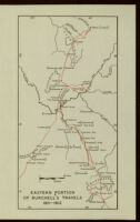
Eastern portion of Burchell's travels 1811-1812 Date: [1953] Resource Type: cartographic Collection: Southern African Maps in Books
General plan of the Kroome Mountain &c. Water Kloof Date: [1856] Resource Type: cartographic Collection: Southern African Maps in Books
Hondius: Klare besgryving van Cabo de Bona Esperancia page 32 Collection: Southern African Maps in Books
Islands in the Atlantic Date: [1851-57] Resource Type: cartographic Collection: Southern African Maps in Books
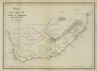
Kaart van Natalia en van Afrika's zuidhoek opgemaakt in 1846 door G. Lauts Date: 1846 Resource Type: cartographic Collection: Southern African Maps in Books
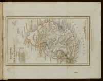
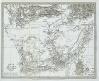
Kaart von Zuid-Afrika Date: 1854 Resource Type: cartographic Collection: Southern African Maps in Books
Karte des europaeischen gebiets am Vorgebirge der Guten Hoffnung Date: 1811 Resource Type: cartographic Collection: Southern African Maps in Books
Kostantinah, and its immediate environs. 1837 Date: [1839] Resource Type: cartographic Collection: Southern African Maps in Books
lichtenstein: Reisen im sul dlichen Afrika in den Jahren... Collection: Southern African Maps in Books
Lourenço Marques (Bahia); planta levantada ultimamente (em 1825) pelo Capitão Owen da Marinha Britanica Date: [1835-1837] Resource Type: cartographic Collection: Southern African Maps in Books
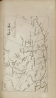
Map illustrative of tour of Messrs. Arbonsset & Doumos Date: [1968] Resource Type: cartographic Collection: Southern African Maps in Books
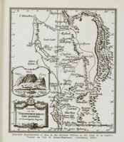
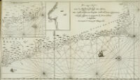
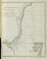
[Map of Saladanha Bay] Date: [1816] Resource Type: cartographic Collection: Southern African Maps in Books
Map of South Africa Date: [1856] Resource Type: cartographic Collection: Southern African Maps in Books
Map of the Cape of Good Hope Date: [1856] Resource Type: cartographic Collection: Southern African Maps in Books
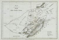
[Map of the Cape of Good Hope] Date: [1916-32] Resource Type: cartographic Collection: Southern African Maps in Books
Map of the Colony of Natal from the Umzimvubu River to Point Durnford Date: 1852 Resource Type: cartographic Collection: Southern African Maps in Books
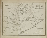
Map of the scene of the present war in Kaffirland Date: 1851 Resource Type: cartographic Collection: Southern African Maps in Books
Mappa geographica Promontorii Bonae Spei Date: 1785 Resource Type: cartographic Collection: Southern African Maps in Books
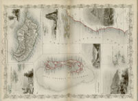
Mauritius or Isle of France Date: 1836 Resource Type: cartographic Collection: Southern African Maps in Books
Natal and Kaffraria Date: [1851-57] Resource Type: cartographic Collection: Southern African Maps in Books
Pas-kaarte van de zuyd-west-kust van Africa; van Cabo Negro tot beoosten Cabo de Bona Esperanca. Niiwlyks besgreven en uyt-gegeven by Jodocus Hondius, etc. Date: 1652 Resource Type: cartographic Collection: Southern African Maps in Books
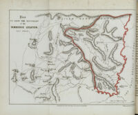
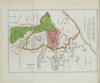
Plan to show the boundary of the Tambookie location Date: 1856 Resource Type: cartographic Collection: Southern African Maps in Books
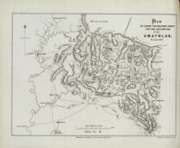
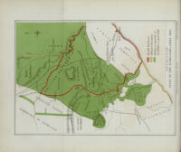
Plan to show the military posts for the occupation of the Amatolas Date: 1856 Resource Type: cartographic Collection: Southern African Maps in Books
Port Natal and country adjacent Date: [1839] Resource Type: cartographic Collection: Southern African Maps in Books
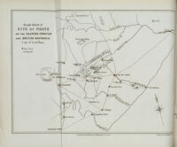
Rough sketch of site of posts on the eastern frontier and British Kaffraria (Cape of Good Hope) Date: [1856] Resource Type: cartographic Collection: Southern African Maps in Books
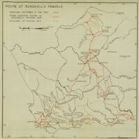
Route of Burchell's Travels Date: [1953] Resource Type: cartographic Collection: Southern African Maps in Books
Skeleton map of a portion of the eastern frontier of the Cape of Good Hope Date: [n.d.] Resource Type: cartographic Collection: Southern African Maps in Books
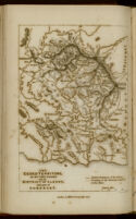
Sketch map of the eastern frontier Date: 1837 Resource Type: cartographic Collection: Southern African Maps in Books
Sketch map of the seat of war Date: [1848] Resource Type: cartographic Collection: Southern African Maps in Books
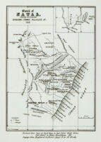
Sketch of Natal, showing its proposed divisions, towns, villages, &c. Date: 1850 Resource Type: cartographic Collection: Southern African Maps in Books
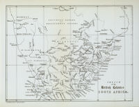
Sketch of the British Colonies South Africa Date: [1963] Resource Type: cartographic Collection: Southern African Maps in Books
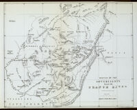
Sketch of the sovereignty beyond the Orange River Date: [1963] Resource Type: cartographic Collection: Southern African Maps in Books
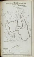
Sketch showing the site of operations near Thaba Bosigo Date: 1856 Resource Type: cartographic Collection: Southern African Maps in Books
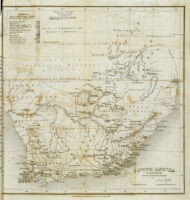
South Africa; compiled for the Revd R. Moffat's work Date: 1842 Resource Type: cartographic Collection: Southern African Maps in Books
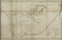
South Africa; compiled from the M.S. maps in the Colonial Office Date: 1834 Resource Type: cartographic Collection: Southern African Maps in Books
State of the frontier since the peace, April 1853 Date: 1856 Resource Type: cartographic Collection: Southern African Maps in Books
State of the rebellion, April 1852 Date: 1856 Resource Type: cartographic Collection: Southern African Maps in Books
The ceded territory on the Caffer frontier; with the district of Albany, and part of Somerset Date: 1834 Resource Type: cartographic Collection: Southern African Maps in Books
The ports of Conducia, Mozambique and Mokamba, on the east coast of Africa Date: 1824 Resource Type: cartographic Collection: Southern African Maps in Books
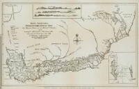
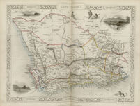
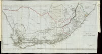
The southern division of the Cape of Good Hope colony Resource Type: cartographic Collection: Southern African Maps in Books
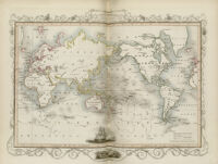
The world on Mercator projection shewing the voyages of Captain Cook round the world Date: [1851-57] Resource Type: cartographic Collection: Southern African Maps in Books
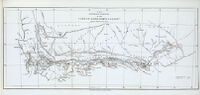
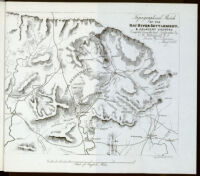
Topographical sketch of the Kat River settlement, & adjacent country Date: 1852 Resource Type: cartographic Collection: Southern African Maps in Books
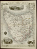
Van Diemen's Island or Tasmania Date: [1851-57] Resource Type: cartographic Collection: Southern African Maps in Books
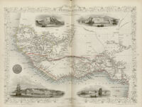
Western Africa Date: [1851-57] Resource Type: cartographic Collection: Southern African Maps in Books
![[Autograph letter from R. B. Fisher]](https://iiif.library.ucla.edu/iiif/2/ark%3A%2F21198%2Fzz002bwsnt/full/!200,200/0/default.jpg)


![[Map of Saladanha Bay]](https://iiif.library.ucla.edu/iiif/2/ark%3A%2F21198%2Fzz002bwspb/full/!200,200/0/default.jpg)
![[Map of the Cape of Good Hope]](https://iiif.library.ucla.edu/iiif/2/ark%3A%2F21198%2Fzz002bwtrv/full/!200,200/0/default.jpg)