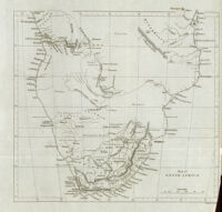
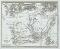
Map of South Africa Date: [1856] Resource Type: cartographic Collection: Southern African Maps in Books
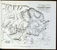
Topographical sketch of the Kat River settlement, & adjacent country Date: 1852 Resource Type: cartographic Collection: Southern African Maps in Books
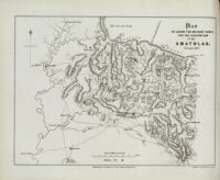
Plan to show the military posts for the occupation of the Amatolas Date: 1856 Resource Type: cartographic Collection: Southern African Maps in Books
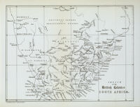
Sketch of the British Colonies South Africa Date: [1963] Resource Type: cartographic Collection: Southern African Maps in Books
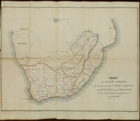
South Africa; compiled from the M.S. maps in the Colonial Office Date: 1834 Resource Type: cartographic Collection: Southern African Maps in Books
Kaart von Zuid-Afrika Date: 1854 Resource Type: cartographic Collection: Southern African Maps in Books