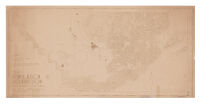
1932 Kern County, California population densities Description: the Kern County Planning Commission. Date: [1932] Resource Type: cartographic Collection: Henry J. Bruman Map Collection
1940 population distribution, Kern County, California Description: Relief represented by hachures. Date: [1940?] Resource Type: cartographic Collection: Henry J. Bruman Map Collection
Automobile road map of Kern County, California Description: Relief represented by hachures. Date: [192-?] Resource Type: cartographic Collection: Henry J. Bruman Map Collection
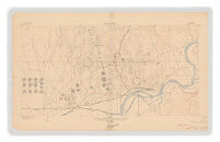
California (Kern County), Oil Center special map. Description: Relief represented by contours. Date: 1906 Resource Type: cartographic Collection: Henry J. Bruman Map Collection
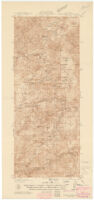
California Tobias Peak quadrangle Description: Includes location map, "Diagram of township," and notes. Date: [1936?] Resource Type: cartographic Collection: Henry J. Bruman Map Collection
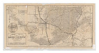
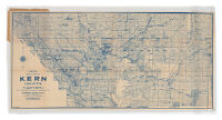
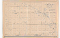
Denny's pocket map of Kern County, California Description: Relief represented by hachures. Date: c1911 Resource Type: cartographic Collection: Henry J. Bruman Map Collection
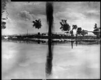
Lake View, Gusher, Sunset Oil Field, Kern County Description: View of a gusher at Lake View Date: [between 1910-1930] Resource Type: still image Photographer: Pierce, C. C. $q(Charles C.), $d1861-1946 Collection: C.C. Pierce Photographic Collection, circa 1898-1934
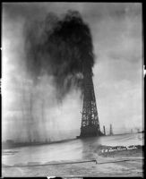
Lake View Oil Co. gusher at the Sunset Oil Field, Kern County, 1920-1930 Description: View of a gusher emanating from a tall oil derrick belonging to the Lake View Oil Co. at the Sunset Oil Field. A cloud of oil fills the air and the ground is shiny with oil as well. Other derricks are visible in the distance. Date: [between 1920-1930] Resource Type: still image Photographer: Pierce, C. C. $q(Charles C.), $d1861-1946 Collection: C.C. Pierce Photographic Collection, circa 1898-1934
Luz International solar plant in Boron, Calif., 1989 Date: January 9, 1989 Resource Type: still image Photographer: Gabriel, Robert Collection: Los Angeles Times Photographic Collection
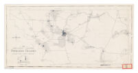
Map of Elk Hills Oil Field Kern County, CA Date: 1921 Resource Type: cartographic Collection: Henry J. Bruman Map Collection