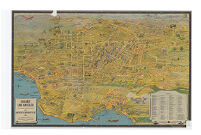
Greater Los Angeles Description: designed by K.M. Leuschner. copyrighted. Published by Metropolitan Surveys. Date: 1932 Resource Type: cartographic Collection: Henry J. Bruman Map Collection
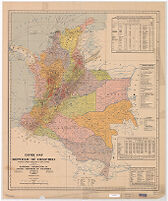
Coffee Map of the Republic of Colombia World's Largest Producer of Mild Coffees. Date: 1939 Resource Type: cartographic Collection: Henry J. Bruman Map Collection
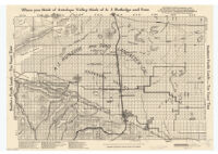
California, Indian Valley map. Date: 1907 Resource Type: cartographic Collection: Henry J. Bruman Map Collection
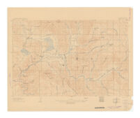
Minor civil divisions, judicial townships Description: "O-304017." Date: 1941 Resource Type: cartographic Collection: Henry J. Bruman Map Collection
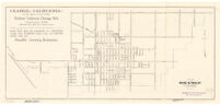
Map of Orange, Orange County, California. Description: Text and ill. on verso. Date: [192-?] Resource Type: cartographic Collection: Henry J. Bruman Map Collection
Map of Part of the State of Rio de Janeiro Showing Hydro-electric Plants, Transmission Lines, Etc. Date: 1936 Resource Type: cartographic Collection: Henry J. Bruman Map Collection
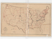
Project for the Development of National Highways of the United States W.P.D. 484-16 Date: 1921 Resource Type: cartographic Collection: Henry J. Bruman Map Collection
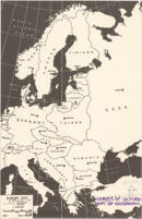
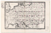
Für die Zusammenstellung der Blätter der Karte von Central - Europa. Date: 1856 Resource Type: cartographic Collection: Henry J. Bruman Map Collection
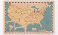
Domestic Air Mail Service in the United States Date: 1938 Resource Type: cartographic Collection: Henry J. Bruman Map Collection
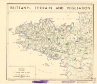
Brittany: Terrain and Vegetation Date: 1943 Resource Type: cartographic Collection: Henry J. Bruman Map Collection
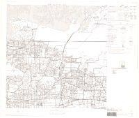
County block map (1990), Los Angeles County (037), state, California (06). PS 53 Description: Computer generated maps. Maps plotted in 1991. Date: 1991- Resource Type: cartographic Collection: Henry J. Bruman Map Collection
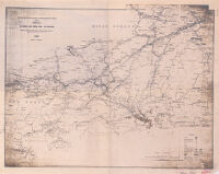
Map of the Congo River between Leopoldville and Stanley Falls. 3 : from running surveys in the steamers "Peace" and "Goodwill" Description: "The Geographical journal 1902." Date: [1902] Resource Type: cartographic Collection: Henry J. Bruman Map Collection
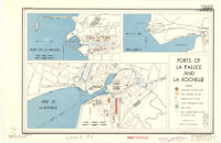
Ports of La Pallice and La Rochelle Description: Dated: 24 February 1944. Date: 1944 Resource Type: cartographic Collection: Henry J. Bruman Map Collection
Los Angeles County oil map, Los Angeles County, Cal. : showing the more important tank farms, storage reservoirs, and refineries not shown on other Sanborn maps no. 12 Date: August 1924 Resource Type: cartographic Collection: Henry J. Bruman Map Collection
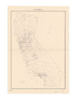
Southern Pacific lands--ten years time Description: Relief represented by hachures. Date: 19391900[19--] Resource Type: cartographic Collection: Henry J. Bruman Map Collection
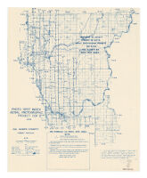
Photo spot index aerial photographic project CDF 2 (1948) Description: Relief represented by hachures. Date: 1949[1949] Resource Type: cartographic Collection: Henry J. Bruman Map Collection
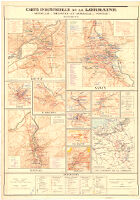
Carte Industrielle de la Lorraine Date: 1930 Resource Type: cartographic Collection: Henry J. Bruman Map Collection