Search
Collection
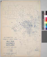
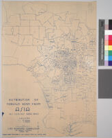
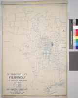
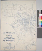
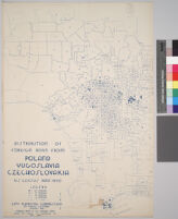
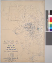
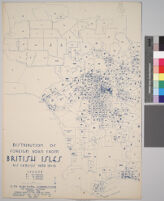
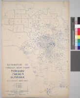
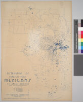
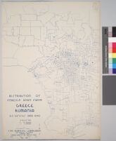
- Maps Showing Distribution of Racial and National Groups in Los Angeles, according to the 1940 United States Census[remove]14
Search Constraints
You searched for:
Resource Type
cartographic
Remove constraint Resource Type: cartographic
Resource Type
still image
Remove constraint Resource Type: still image
Collection
Maps Showing Distribution of Racial and National Groups in Los Angeles, according to the 1940 United States Census
Remove constraint Collection: Maps Showing Distribution of Racial and National Groups in Los Angeles, according to the 1940 United States Census
Start Over