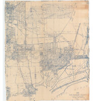
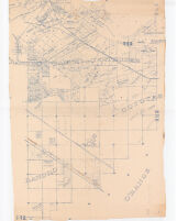
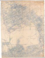
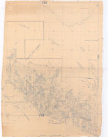
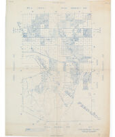
#28 San Pedro Description: Cadastral map showing landowners.; Blue line print.; Some sheets are plastic treated cloth. Date: 1943 Resource Type: cartographic Collection: Henry J. Bruman Map Collection
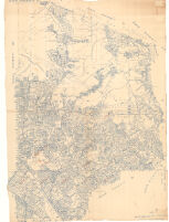
#30 Signal Hill, Long Beach, Cerritos, San Pedro Description: Cadastral map showing landowners.; Blue line print.; Some sheets are plastic treated cloth. Date: 1945 Resource Type: cartographic Collection: Henry J. Bruman Map Collection
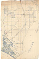
#31 Los Alamitos Description: Cadastral map showing landowners.; Blue line print.; Some sheets are plastic treated cloth. Date: 1945 Resource Type: cartographic Collection: Henry J. Bruman Map Collection
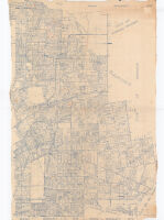
#32 San Antonio, San Pedro, Los Cerritos Description: Cadastral map showing landowners.; Blue line print.; Some sheets are plastic treated cloth. Date: 1943 Resource Type: cartographic Collection: Henry J. Bruman Map Collection
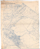
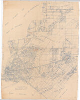
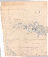
#34 Rancho Santa Gertrudes. Rancho Los Coyotes Description: Cadastral map showing landowners.; Blue line print.; Some sheets are plastic treated cloth. Date: 1941 Resource Type: cartographic Collection: Henry J. Bruman Map Collection
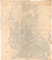
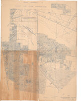
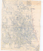
#35 City of Vernon, Rancho San Antonio. Description: Cadastral map showing landowners.; Blue line print.; Some sheets are plastic treated cloth. Date: 1922 Resource Type: cartographic Collection: Henry J. Bruman Map Collection
#36 Rancho San Antonio, Montebello, Monterey Park Description: Cadastral map showing landowners.; Blue line print.; Some sheets are plastic treated cloth. Date: 1946 Resource Type: cartographic Collection: Henry J. Bruman Map Collection
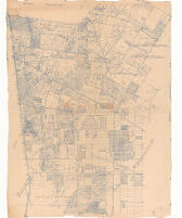
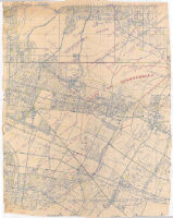
#37 Paso de Bartolo, Whittier, Puente Description: Cadastral map showing landowners.; Blue line print.; Some sheets are plastic treated cloth. Date: 1944 Resource Type: cartographic Collection: Henry J. Bruman Map Collection
#40 Rancho Los Felis Description: Cadastral map showing landowners.; Blue line print.; Some sheets are plastic treated cloth. Date: 1945 Resource Type: cartographic Collection: Henry J. Bruman Map Collection
#40 Rancho Providencia. Rancho Los Feliz. Description: Cadastral map showing landowners.; Blue line print.; Some sheets are plastic treated cloth. Date: 1922 Resource Type: cartographic Collection: Henry J. Bruman Map Collection
#41 Rancho San Rafael and Los Angeles and Vicinity. Watts Subdivision Description: Cadastral map showing landowners.; Blue line print.; Some sheets are plastic treated cloth. Date: 1943 Resource Type: cartographic Collection: Henry J. Bruman Map Collection
#41 Watts Subdivision Description: Cadastral map showing landowners.; Blue line print.; Some sheets are plastic treated cloth. Date: 1922 Resource Type: cartographic Collection: Henry J. Bruman Map Collection
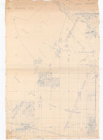
#44 Santa Anita Rancho Description: Cadastral map showing landowners.; Blue line print.; Some sheets are plastic treated cloth. Date: 1946 Resource Type: cartographic Collection: Henry J. Bruman Map Collection
#46 Rancho La Puente Description: Cadastral map showing landowners.; Blue line print.; Some sheets are plastic treated cloth. Date: 1944 Resource Type: cartographic Collection: Henry J. Bruman Map Collection
#47 La Puente, Azusa, Covina Description: Cadastral map showing landowners.; Blue line print.; Some sheets are plastic treated cloth. Date: 1945 Resource Type: cartographic Collection: Henry J. Bruman Map Collection
#51 Rancho La Canada Description: Cadastral map showing landowners.; Blue line print.; Some sheets are plastic treated cloth. Date: 1946 Resource Type: cartographic Collection: Henry J. Bruman Map Collection
#52 Angeles National Forest Description: Cadastral map showing landowners.; Blue line print.; Some sheets are plastic treated cloth. Date: 1944 Resource Type: cartographic Collection: Henry J. Bruman Map Collection
#54 Mission San Fernando Description: Cadastral map showing landowners.; Blue line print.; Some sheets are plastic treated cloth. Date: 1946 Resource Type: cartographic Collection: Henry J. Bruman Map Collection
#56 San Fernando Mission Description: Cadastral map showing landowners.; Blue line print.; Some sheets are plastic treated cloth. Date: 1940 Resource Type: cartographic Collection: Henry J. Bruman Map Collection
#57 Rancho Mission San Fernando Description: Cadastral map showing landowners.; Blue line print.; Some sheets are plastic treated cloth. Date: 1941 Resource Type: cartographic Collection: Henry J. Bruman Map Collection