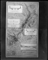
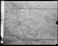
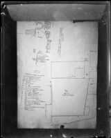
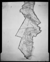
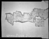
Copy of a map of the Arroyo Seco Parkway, 1936
- Description:
- Copy of a map titled, Arroyo Seco Parkway. The map is produced by the Engineering Department, Automobile Club of Southern California and is dated Feb. 1936. William Neely's signature "W. Neely" sits in the lower right corner. The illustrated map shows the proposed Arroyo Seco Parkway connecting downtown Los Angeles to its northeastern communities. Four inset illustrations depict, from top to bottom: bridge elevation in South Pasadena, typical sections through Arroyo Seco, typical section through South Pasadena and viaduct.
- Date:
- [circa May 2, 1936]
- Resource Type:
- still image
- Collection:
-
OpenUCLA Collections
Los Angeles Times Photographic Collection