Search
Genre
- black-and-white photographs[remove]853
- film stills573
- portrait photographs549
- cellulose nitrate film304
- acetate film68
- more Genre Sim »
Repository
- University of California, Los Angeles. Library. Department of Special Collections[remove]853
- Las Flores Inn (Malibu, Calif.)1
- The June L. Mazer Lesbian Archives1
- Todd and Leslie Mortuary (Santa Monica, Calif.)1
- Topanga Mineral Springs (Topanga, Calif.)1
Search Constraints
You searched for:
Genre
black-and-white photographs
Remove constraint Genre: black-and-white photographs
Repository
University of California, Los Angeles. Library. Department of Special Collections
Remove constraint Repository: University of California, Los Angeles. Library. Department of Special Collections
Date
Unknown
Remove constraint Date: Unknown
Start Over
853 Catalog Results
Search Results
Ray Brown at the Playboy Jazz Festival [descriptive]
![Ray Brown at the Playboy Jazz Festival [descriptive]](https://iiif.library.ucla.edu/iiif/2/ark%3A%2F21198%2Fzz000960kj/full/!200,200/0/default.jpg)
American trumpeter Freddie Hubbard performing [descriptive]
![American trumpeter Freddie Hubbard performing [descriptive]](https://iiif.library.ucla.edu/iiif/2/ark%3A%2F21198%2Fzz000961pk/full/!200,200/0/default.jpg)
Horace Tapscott and the Pan Afrikan Peoples Arkestra [descriptive]
![Horace Tapscott and the Pan Afrikan Peoples Arkestra [descriptive]](https://iiif.library.ucla.edu/iiif/2/ark%3A%2F21198%2Fzz001d6739/full/!200,200/0/default.jpg)
Unidentified location with a large building and houses beyond, New Orleans, 1910
uclamss_119_0050i - Metadata source image - not to be cataloged
uclamss_119_0060i - Metadata source image - not to be cataloged

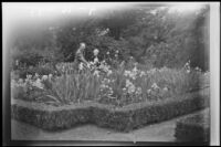
Alice Gibbs and Dwight Gibbs in an iris garden, (Los Angeles?), 1941
uclamss_119_0208i - Metadata source image - not to be cataloged
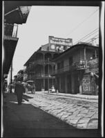
Buildings with wrought iron balconies on Royal St. in the French Quarter, New Orleans, 1910
uclamss_119_0085i - Metadata source image - not to be cataloged

Exterior view of the home of Rebecca Spring and her daughter Jeanie Peet, Los Angeles, circa 1900
uclamss_119_0015i - Metadata source image - not to be cataloged

Olive Percival with a woman companion and a (driver?) at Brighton Beach, Brooklyn, 1910
uclamss_119_0095i - Metadata source image - not to be cataloged

Helen Percival, Olive Percival's mother, in their Arroyo Seco garden, Los Angeles, 1913
Los Angeles City Hall the year it was completed, 1928
Snow on Olive Percival's Arroyo Seco property, Los Angeles, 1916
uclamss_119_0048i - Metadata source image - not to be cataloged
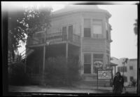
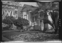
Victorian house next to a pharmacy photographed by Olive Percival, (Los Angeles?), 1927
uclamss_119_0191i - Metadata source image - not to be cataloged
uclamss_119_0045i - Metadata source image - not to be cataloged
C.C. Pierce Photographic Collection, circa 1898-1934
Exterior view of the Todd and Leslie Mortuary, Santa Monica
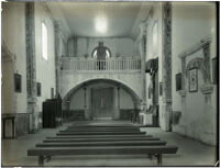
Interior of church at Mission San Luis Rey de Francia, Oceanside, 1899
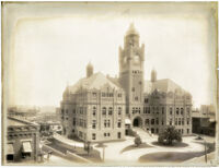
Los Angeles County Courthouse, Los Angeles, circa 1900-1910
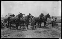
Four horses harnessed to carts, plow, and two farm workers
Topanga Mineral Springs, Topanga, circa 1920-1930
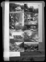
Ten postcard views of the Outside Inn and Topanga Canyon, Topanga, circa 1920-1928
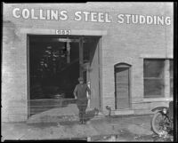
Exterior view of the business location of Collins Steel Studding, circa 1920-1930
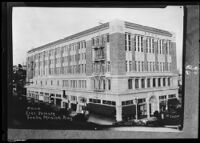
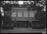
Elks Temple, Santa Monica
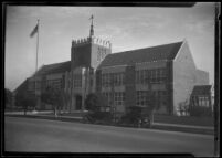
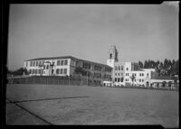
Madison School, Santa Monica, circa 1920-1930
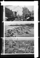
Postcard views of the pier, Venice
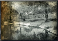
Sheep washing pond at Rancho Guajome, Vista vicinity, circa 1890-1901
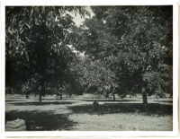
Walnut grove in Whittier
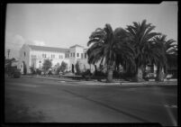
Santa Monica Bay Woman's Club, Santa Monica
McKinley School, Santa Monica, circa 1920-1929
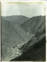
Mountain area with bare canyon (unidentified), California, circa 1880-1900
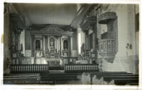
Mission San Buenaventura, interior of church showing pulpit and altar, Ventura, ca. 1888
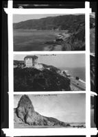
Views of the lighthouse, the Villa de Leon and Castle Rock along the of Santa Monica Bay, Pacific Palisades and Topanga, circa 1920-1927
Exterior view of the Todd and Leslie Mortuary, Santa Monica
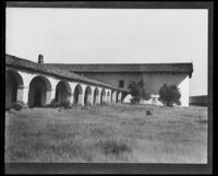
Mission San Miguel Arcangel, exterior view from the southeast, San Miguel
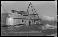
La Vina Mutual Water Co. pumping plant no. 1, La Vina
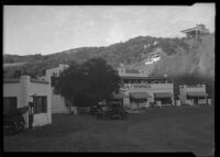
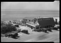
Exterior view of the Las Flores Inn on the coast road, Malibu, 1915
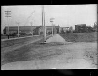
Fifth Street looking east toward the Southern Pacific Arcade Depot, Los Angeles, circa 1890
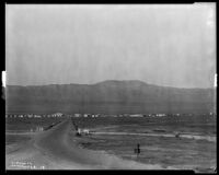
View towards the town of Avenal in the Salinas valley with the Santa Lucia mountain range in the distance, Avenal, circa 1929
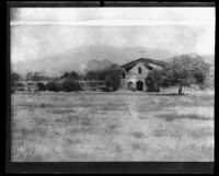
Mission San Antonio de Pádua before restoration, near King City, circa 1906
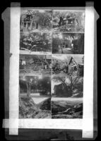
Ten views of Kneen's Kamp and Topanga Canyon, Topanga, circa 1918-1930
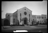
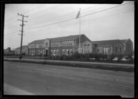
Exterior view of an unidentified building (school?), California
z - uclamss_2213_01794i