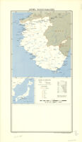
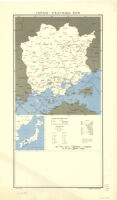
Northern Japan Description: 1st ed. Date: 1945 Resource Type: cartographic Collection: East Asian Maps in the Bruman Collection
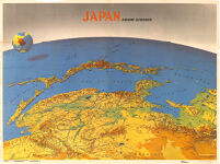
Japan From Siberia Date: 1943 Resource Type: cartographic Collection: East Asian Maps in the Bruman Collection
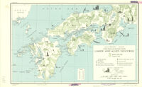
Southwest Japan (Kyushu, Shikoku, And Southwest Honshu) Lumber And Allied Industries Description: Provisional ed. Date: 31 July 1944 Resource Type: cartographic Collection: East Asian Maps in the Bruman Collection
Southwest Japan (Kyushu, Shikoku, And Southwest Honshu) Water Works And Springs Description: Provisional ed. Date: 31 July 1944 Resource Type: cartographic Collection: East Asian Maps in the Bruman Collection
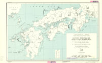
Southwest Japan (Kyushu, Shikoku, And Southwest Honshu) Cotton Spinning, Silk And Rayon Production Description: Provisional ed. Date: 31 July 1944 Resource Type: cartographic Collection: East Asian Maps in the Bruman Collection
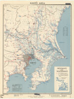
Kanto Area / Highways And Waterways Description: Provisional ed. Date: 11 November 1944 Resource Type: cartographic Collection: East Asian Maps in the Bruman Collection
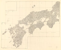
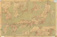
Map Of Kyushu, Shikoku & Southern Honshu Description: Provisional ed. Date: 1945 Resource Type: cartographic Collection: East Asian Maps in the Bruman Collection
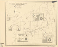
Japanese rubber tire industry including Japanese held mainland Description: Includes insets showing names and locations of tire companies, with individual plant capacity in rubber tires per day and percentage of apparent total Japanese capacity. Date: May 6, 194219421942] Resource Type: cartographic Collection: East Asian Maps in the Bruman Collection
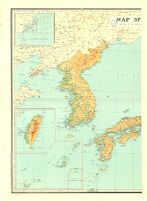
Japan and Korea Description: Insets: 1-2. Kuril Islands.--3. Pescadores.--4. Karafuto.--5-7. Ryukyu Islands.--8. Formosa.--9. Tokyo.--10. Location of Japan in the Western Pacific. Date: 1945December 1945 Resource Type: cartographic Collection: East Asian Maps in the Bruman Collection
Map Of Japan, Compiled By The Land Survey Department, Japan Date: 1938 Resource Type: cartographic Collection: East Asian Maps in the Bruman Collection
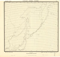
Northern Japanese fisheries Description: Outline map showing 200 meter submarine contour of Japan, as well as the mainlands that border Sea of Japan and Sea of Okhotsk. Date: May 19, 1942[1942] Resource Type: cartographic Collection: East Asian Maps in the Bruman Collection
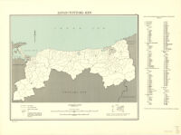
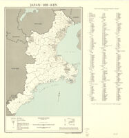
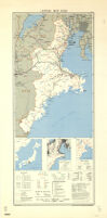
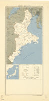
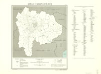
Japan: Mie-Ken Date: July 1946 Resource Type: cartographic Collection: East Asian Maps in the Bruman Collection
Japan: Mie-Ken Date: July 1946 Resource Type: cartographic Collection: East Asian Maps in the Bruman Collection
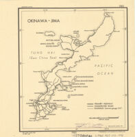
Okinawa-Jima Description: Provisional ed. Date: 24 April 1945 Resource Type: cartographic Collection: East Asian Maps in the Bruman Collection
Travellers' map of Japan, 1939 Description: Ancillary maps: Tyōsen -- Taiwan -- General map of Japan -- Hokkaido -- Karahuto -- Okinawa -- Ōsaka -- Tōkyō. Date: [1939] Resource Type: cartographic Collection: East Asian Maps in the Bruman Collection
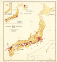
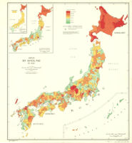
Japan Population Density, 1940 Census By Gun Date: June 1947 Resource Type: cartographic Collection: East Asian Maps in the Bruman Collection
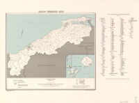
Japan: Iwate-Ken Date: February 1947 Resource Type: cartographic Collection: East Asian Maps in the Bruman Collection
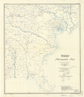
Tokyo Metropolitan Area Description: Provisional ed. Date: October 15, 1944 Resource Type: cartographic Collection: East Asian Maps in the Bruman Collection
Japan: Fukui-Ken Date: January 1947 Resource Type: cartographic Collection: East Asian Maps in the Bruman Collection
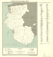
Japan: Wakayama-Ken Date: January 1947 Resource Type: cartographic Collection: East Asian Maps in the Bruman Collection
Japan: Yamanashi-Ken Date: February 1947 Resource Type: cartographic Collection: East Asian Maps in the Bruman Collection
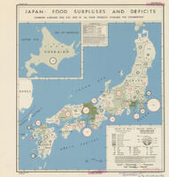
Japan: Food Surpluses And Deficits / Combined Averages (1935, 1937, 1939) Of All Food Products Available For Consumption Date: 27 June 1945 Resource Type: cartographic Collection: East Asian Maps in the Bruman Collection
Japan Sex Ratio, 1940 By Gun Date: June 1947 Resource Type: cartographic Collection: East Asian Maps in the Bruman Collection
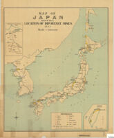
Map Of Japan Showing Location Of Important Mines 1913 Date: 1913 Resource Type: cartographic Collection: East Asian Maps in the Bruman Collection
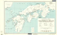
Southwest Japan (Kyushu, Shikoku, And Southwest Honshu) Non-Ferrous Metals / Mines And Processing Plants Description: Provisional ed. Date: 31 July 1944 Resource Type: cartographic Collection: East Asian Maps in the Bruman Collection
Sketch Map Of Kinawa Shima And Adjacent Islands Mansei Shoto As Of 10 October 1944 Date: 10 October 1944 Resource Type: cartographic Collection: East Asian Maps in the Bruman Collection
Osaka-Ko Se Description: 1st ed. Date: 1945 Resource Type: cartographic Collection: East Asian Maps in the Bruman Collection
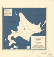
Hokkaido-Cho Administrative Divisions Date: 16 September 1944 Resource Type: cartographic Collection: East Asian Maps in the Bruman Collection
Japan: Hyogo-Ken Date: November 1946 Resource Type: cartographic Collection: East Asian Maps in the Bruman Collection
Japan: Saga-Ken Description: Provisional ed. Date: 5 October 1945 Resource Type: cartographic Collection: East Asian Maps in the Bruman Collection
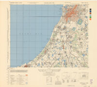
AAF TARGET CHART JAPAN NO. 1386 Description: 2nd ed. Date: January 1944 Resource Type: cartographic Collection: East Asian Maps in the Bruman Collection
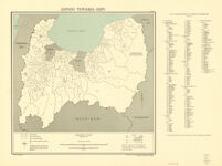
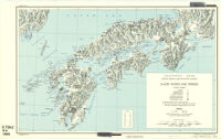
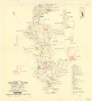
[Hokkaidō physiographic diagram] Description: Title supplied by cataloger. Date: 1945 Resource Type: cartographic Collection: East Asian Maps in the Bruman Collection
Japan: Wakayama-Ken Date: August 1946 Resource Type: cartographic Collection: East Asian Maps in the Bruman Collection
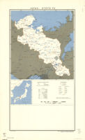
Japan: Kyoto-Fu Date: February 1947 Resource Type: cartographic Collection: East Asian Maps in the Bruman Collection
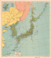
Indispensable Map Of Japan And Its Possessions In Beautiful Colors Date: 1941 Resource Type: cartographic Collection: East Asian Maps in the Bruman Collection
Japan: Toyama-Ken Date: August 1946 Resource Type: cartographic Collection: East Asian Maps in the Bruman Collection
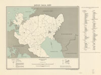
Japan: Saitama-Ken Date: April 1947 Resource Type: cartographic Collection: East Asian Maps in the Bruman Collection
Tourist Map Of Setonaikai (Seto Inland Sea) Date: 明治四十四年八月二十日 Resource Type: cartographic Collection: East Asian Maps in the Bruman Collection
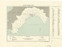
Japan: Shimane-Ken Date: April 1947 Resource Type: cartographic Collection: East Asian Maps in the Bruman Collection
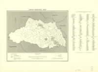
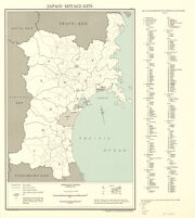
Japan: Miyagi-Ken Date: February 1947 Resource Type: cartographic Collection: East Asian Maps in the Bruman Collection
Japan: Tottori-Ken Date: April 1947 Resource Type: cartographic Collection: East Asian Maps in the Bruman Collection
Japan: Kochi - Ken Date: February 1947 Resource Type: cartographic Collection: East Asian Maps in the Bruman Collection
Japan: Saga-Ken Date: February 1947 Resource Type: cartographic Collection: East Asian Maps in the Bruman Collection
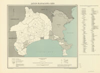
Japan: Kanagawa-Ken Date: November 1943 Resource Type: cartographic Collection: East Asian Maps in the Bruman Collection
Japan: Mie-Ken Date: February 1947 Resource Type: cartographic Collection: East Asian Maps in the Bruman Collection
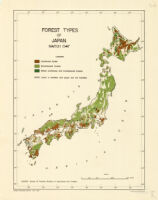
Forest types of Japan : March 1947 Description: Source: Bureau of Forestry, Ministry of Agriculture and Forestry. Date: 1947March 1947 Resource Type: cartographic Collection: East Asian Maps in the Bruman Collection
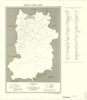
Japan: Nara-Ken Date: February 1947 Resource Type: cartographic Collection: East Asian Maps in the Bruman Collection
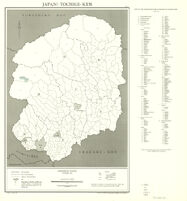
Japan: Tochigi-Ken Date: January 1947 Resource Type: cartographic Collection: East Asian Maps in the Bruman Collection
Japan: Okayama-Ken Date: November 1946 Resource Type: cartographic Collection: East Asian Maps in the Bruman Collection
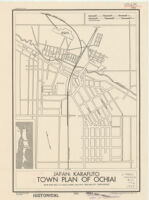
Japan: Karafuto Town Plan Of Ochiai / Base Map: Map Of Ochiai: 1:4,000. June, 1929. (Reliability Unknown) Description: Provisional ed. Date: 4 June 1945 Resource Type: cartographic Collection: East Asian Maps in the Bruman Collection


![[Hokkaidō physiographic diagram]](https://iiif.library.ucla.edu/iiif/2/ark%3A%2F21198%2Fzz002hf4kv/full/!200,200/0/default.jpg)