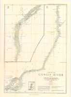
Map of the Congo River between Leopoldville and Stanley Falls. 1 : from running surveys in the steamers "Peace" and "Goodwill"
Item Overview
- Title
- Map of the Congo River between Leopoldville and Stanley Falls. 1 : from running surveys in the steamers "Peace" and "Goodwill"
- Cartographer
- Grenfell, George, $d 1849-1906
- Date Created
- 1902
- Date
- 1902
- Place of Origin
- [London]
- Publisher
- Royal Geographical Society
- Language
- English
- Collection
- Henry J. Bruman Map Collection
Notes
- Description
-
"The Geographical journal 1902."
Includes index map and inset of "The upper River Lindi to the Falls station."
Physical Description
- Extent
- 1 map on 5 sheets : col.
Find This Item
- Repository
- University of California, Los Angeles. Library. Henry J. Bruman Map Collection
- ARK
- ark:/21198/zz002jkt2z
- Manifest url
-

Access Condition
- Rights statement
- unknown