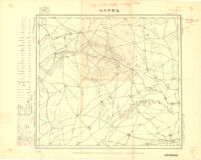
Ta-Erh-Han-Wang-Fu
Item Overview
- Title
- Ta-Erh-Han-Wang-Fu
- Alternative title
- 達爾罕王府
- Date Created
- 昭和七年十二月二十五日
- Date
- 1932-12-25
- Language
-
Japanese
Chinese - Collection
- East Asian Maps in the Bruman Collection
Notes
- Note
-
southernmost:N0434000
westernmost:E1220000
easternmost:E1223000
northernmost:N0440000
Keywords
- Genre
- map
- Subject Geographic
- Manchuria (China)--Maps
- Location
-
Manchuria(China)
100000 - Resource type
- cartographic
Find This Item
- Repository
- University of California, Los Angeles. Library. Henry J. Bruman Map Collection
- Local Identifier
-
Monograph_Maps
G7832_100_J1LS_1932 - ARK
- ark:/21198/zz002hgjmm
- Manifest url
-

Access Condition
- Rights statement
- public domain
- Funding Note
- Access to this collection is generously supported by Sammy Yukuan Lee Foundation.