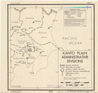
Kanto Plain administrative divisions
Item Overview
- Title
- Kanto Plain administrative divisions
- Date Created
- 1944
- Place of Origin
-
[Washington?]
dcu - Publisher
- Reproduction Branch, OSS
- Language
- English
- Collection
- East Asian Maps in the Bruman Collection
Notes
- Description
-
Provisional ed.
"No. 5286 - R & A, OSS." - Note
-
westernmost:W1390000
easternmost:E1420000
northernmost:N0370000
southernmost:N0353000
Physical Description
- Extent
- 1 map ; 28 x 28 cm.
Keywords
- Genre
- map
- Location
-
Kantō Region (Japan)
1000000 - Resource type
- cartographic
- Subjects
- Kantō Region (Japan)--Administrative and political divisions--Maps
Find This Item
- Repository
- University of California, Los Angeles. Library. Henry J. Bruman Map Collection
- Local Identifier
-
Monograph_Maps
G7962_F7_1M_OSS_1944_EDProv - ARK
- ark:/21198/zz002hf732
- Manifest url
-

Access Condition
- Rights statement
- public domain
- Funding Note
- Access to this collection is generously supported by Sammy Yukuan Lee Foundation.