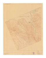
Taylorsville, Cal
Item Overview
- Title
- Taylorsville, Cal
- Uniform title
-
Taylorsville map, California
California, Taylorsville map - Creator
- Geological Survey (U.S.).
- Date Created
- 1910
- Place of Origin
-
[Washington, D.C.]
dcu - Publisher
- U.S. Geological Survey
- Language
- English
- Collection
- Henry J. Bruman Map Collection
Notes
- Description
-
Text and legend on verso.
Relief represented by contours.
U.S. Geological Survey ; A.H. Thompson, geographer ; E.M. Douglas, topographer in charge ; topography by A.F. Dunnington.
Contour interval 50 feet.
"Surveyed in 1891." - Caption
- Ed. of Sept. 1893, repr. Apr. 1910.
Physical Description
- Extent
- 1 map : col. ; 45 x 35 cm.
Keywords
- Genre
-
map
Topographic maps. - Names
-
Thompson, A. H. (Almon Harris). 1839-1906.
Dunnington, A. F.
Douglas, E. M. (Edward Morehouse). 1855-1932. - Subject Geographic
- Plumas County (Calif.)--Maps
- Location
-
southernmost:N0400000
northernmost:N0400800
easternmost:W1204800
Plumas County (Calif.)
westernmost:W1205600 - Resource type
- cartographic
Find This Item
- Repository
- University of California, Los Angeles. Library. Henry J. Bruman Map Collection
- ARK
- ark:/21198/zz002c1z35
- Opac url
- https://search.library.ucla.edu/permalink/01UCS_LAL/17p22dp/alma9968299183606533
- Manifest url
-

Access Condition
- Rights statement
-
unknown
public domain