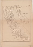
California, 1931 : counties, townships.
Item Overview
- Title
- California, 1931 : counties, townships.
- Creator
- United States. Bureau of Agricultural Economics.
- Date Created
-
1931
[1931] - Place of Origin
-
[Washington, D.C.]
dcu - Publisher
- U.S. Dept. of Agriculture, Bureau of Agricultural Economics
- Language
- English
- Collection
- Henry J. Bruman Map Collection
Notes
- Description
-
"Neg.23950-A."
Includes "Key to counties."
Brown line print.
Physical Description
- Extent
- 1 map : photocopy ; 78 x 62 cm.
Keywords
- Genre
- map
- Location
-
easternmost:W1140700
northernmost:N0420000
California
southernmost:N0323200
westernmost:W1242500 - Resource type
- cartographic
- Subjects
- California--Administrative and political divisions--Maps
Find This Item
- Repository
- University of California, Los Angeles. Library. Henry J. Bruman Map Collection
- ARK
- ark:/21198/zz002bfqcw
- Opac url
- https://search.library.ucla.edu/permalink/01UCS_LAL/17p22dp/alma9934691513606533
- Manifest url
-

Access Condition
- Rights statement
- pd_usfed