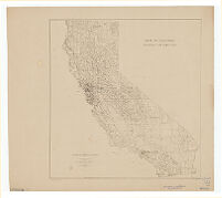
State of California, rainfall distribution
Item Overview
- Title
- State of California, rainfall distribution
- Uniform title
- Rainfall distribution
- Creator
- Land Planning Consultant for California.
- Date Created
- 1934
- Place of Origin
-
[United States
xxu - Publisher
- s.n.]
- Language
- English
- Collection
- Henry J. Bruman Map Collection
Notes
- Description
-
Brown line print.
prepared for National Resources Board and the California State Planning Board, Land-use Adjustment Survey ; submitted by Land Planning Consultant For California.
Physical Description
- Extent
- 1 map : photocopy ; 40 x 38 cm.
Keywords
- Genre
- map
- Names
-
United States. National Resources Board.
California. Land-use Adjustment Survey. - Location
-
easternmost:W1140700
northernmost:N0420000
California
westernmost:W1242500
southernmost:N0323200 - Resource type
- cartographic
- Subjects
- Rain and rainfall--California--Maps
Find This Item
- Repository
- University of California, Los Angeles. Library. Henry J. Bruman Map Collection
- ARK
- ark:/21198/zz002bfjz8
- Opac url
- https://search.library.ucla.edu/permalink/01UCS_LAL/17p22dp/alma9920491903606533
- Manifest url
-

Access Condition
- Rights statement
- pd_usfed